You are here: Home > Network List > TA - USArray Transportable Network (new EarthScope stations) Stations List
> Station X43A Marvell, AR, USA > Earthquake Result Viewer
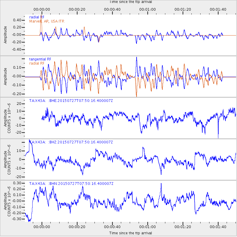
X43A Marvell, AR, USA - Earthquake Result Viewer
*The percent match for this event was below the threshold and hence no stack was calculated.
| Earthquake location: |
Fox Islands, Aleutian Islands |
| Earthquake latitude/longitude: |
52.5/-169.7 |
| Earthquake time(UTC): |
2015/07/27 (208) 07:41:02 GMT |
| Earthquake Depth: |
16 km |
| Earthquake Magnitude: |
5.6 MB |
| Earthquake Catalog/Contributor: |
NEIC PDE/NEIC COMCAT |
|
| Network: |
TA USArray Transportable Network (new EarthScope stations) |
| Station: |
X43A Marvell, AR, USA |
| Lat/Lon: |
34.52 N/90.88 W |
| Elevation: |
53 m |
|
| Distance: |
57.1 deg |
| Az: |
74.879 deg |
| Baz: |
314.322 deg |
| Ray Param: |
$rayparam |
*The percent match for this event was below the threshold and hence was not used in the summary stack. |
|
| Radial Match: |
60.481197 % |
| Radial Bump: |
400 |
| Transverse Match: |
60.925247 % |
| Transverse Bump: |
400 |
| SOD ConfigId: |
7422571 |
| Insert Time: |
2019-04-20 00:51:05.462 +0000 |
| GWidth: |
2.5 |
| Max Bumps: |
400 |
| Tol: |
0.001 |
|
Signal To Noise
| Channel | StoN | STA | LTA |
| TA:X43A: :BHZ:20150727T07:50:16.400007Z | 1.2782903 | 8.1871995E-6 | 6.404805E-6 |
| TA:X43A: :BHN:20150727T07:50:16.400007Z | 1.6178983 | 1.9335207E-7 | 1.1950817E-7 |
| TA:X43A: :BHE:20150727T07:50:16.400007Z | 1.328317 | 6.1649243E-6 | 4.641154E-6 |
| Arrivals |
| Ps | |
| PpPs | |
| PsPs/PpSs | |


