You are here: Home > Network List > US - United States National Seismic Network Stations List
> Station ELK Elko, Nevada, USA > Earthquake Result Viewer
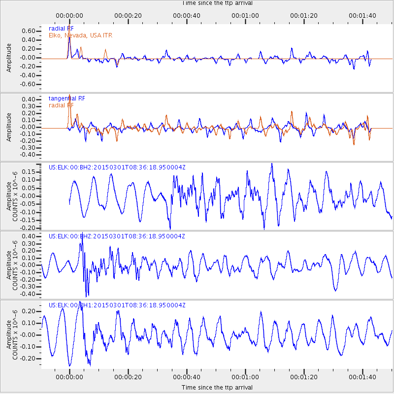
ELK Elko, Nevada, USA - Earthquake Result Viewer
*The percent match for this event was below the threshold and hence no stack was calculated.
| Earthquake location: |
Near Coast Of Guatemala |
| Earthquake latitude/longitude: |
13.4/-91.0 |
| Earthquake time(UTC): |
2015/03/01 (060) 08:30:03 GMT |
| Earthquake Depth: |
20 km |
| Earthquake Magnitude: |
5.5 MWW, 5.2 MWB, 5.5 MWC |
| Earthquake Catalog/Contributor: |
NEIC PDE/NEIC COMCAT |
|
| Network: |
US United States National Seismic Network |
| Station: |
ELK Elko, Nevada, USA |
| Lat/Lon: |
40.74 N/115.24 W |
| Elevation: |
2210 m |
|
| Distance: |
34.5 deg |
| Az: |
326.569 deg |
| Baz: |
135.13 deg |
| Ray Param: |
$rayparam |
*The percent match for this event was below the threshold and hence was not used in the summary stack. |
|
| Radial Match: |
57.84284 % |
| Radial Bump: |
320 |
| Transverse Match: |
61.146255 % |
| Transverse Bump: |
305 |
| SOD ConfigId: |
872571 |
| Insert Time: |
2015-04-11 06:11:15.506 +0000 |
| GWidth: |
2.5 |
| Max Bumps: |
400 |
| Tol: |
0.001 |
|
Signal To Noise
| Channel | StoN | STA | LTA |
| US:ELK:00:BHZ:20150301T08:36:18.950004Z | 1.492148 | 1.5448181E-7 | 1.03529814E-7 |
| US:ELK:00:BH1:20150301T08:36:18.950004Z | 2.604128 | 1.9055034E-7 | 7.317242E-8 |
| US:ELK:00:BH2:20150301T08:36:18.950004Z | 0.91218126 | 7.2312325E-8 | 7.927407E-8 |
| Arrivals |
| Ps | |
| PpPs | |
| PsPs/PpSs | |


