You are here: Home > Network List > GS - US Geological Survey Networks Stations List
> Station KAN11 Stewart Ranch, Harper County, KS, USA > Earthquake Result Viewer
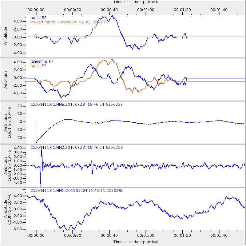
KAN11 Stewart Ranch, Harper County, KS, USA - Earthquake Result Viewer
*The percent match for this event was below the threshold and hence no stack was calculated.
| Earthquake location: |
Northern Chile |
| Earthquake latitude/longitude: |
-22.2/-68.7 |
| Earthquake time(UTC): |
2015/03/28 (087) 16:36:52 GMT |
| Earthquake Depth: |
109 km |
| Earthquake Magnitude: |
6.0 MB |
| Earthquake Catalog/Contributor: |
NEIC PDE/NEIC COMCAT |
|
| Network: |
GS US Geological Survey Networks |
| Station: |
KAN11 Stewart Ranch, Harper County, KS, USA |
| Lat/Lon: |
37.21 N/97.91 W |
| Elevation: |
410 m |
|
| Distance: |
65.2 deg |
| Az: |
334.545 deg |
| Baz: |
150.074 deg |
| Ray Param: |
$rayparam |
*The percent match for this event was below the threshold and hence was not used in the summary stack. |
|
| Radial Match: |
21.000145 % |
| Radial Bump: |
400 |
| Transverse Match: |
37.078297 % |
| Transverse Bump: |
400 |
| SOD ConfigId: |
872571 |
| Insert Time: |
2015-04-11 16:40:52.208 +0000 |
| GWidth: |
2.5 |
| Max Bumps: |
400 |
| Tol: |
0.001 |
|
Signal To Noise
| Channel | StoN | STA | LTA |
| GS:KAN11:01:HHZ:20150328T16:46:51.625029Z | 4.850061 | 1.3820699E-6 | 2.849593E-7 |
| GS:KAN11:01:HHN:20150328T16:46:51.625029Z | 0.32239765 | 6.660374E-7 | 2.0658879E-6 |
| GS:KAN11:01:HHE:20150328T16:46:51.625029Z | 0.40768483 | 3.5984792E-6 | 8.82662E-6 |
| Arrivals |
| Ps | |
| PpPs | |
| PsPs/PpSs | |


