You are here: Home > Network List > CI - Caltech Regional Seismic Network Stations List
> Station MPP McPhearson Peak > Earthquake Result Viewer
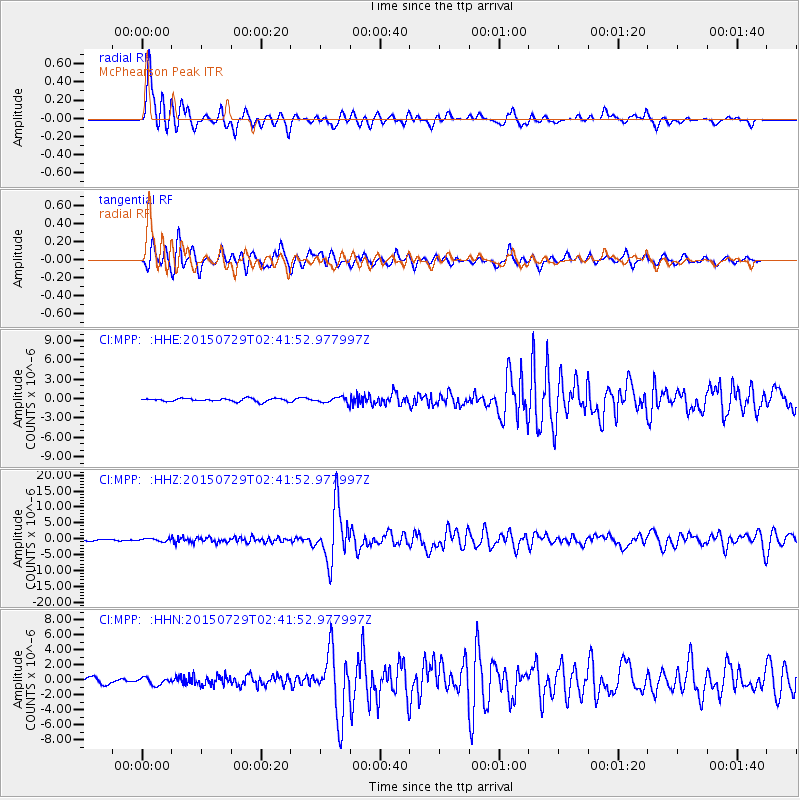
MPP McPhearson Peak - Earthquake Result Viewer
*The percent match for this event was below the threshold and hence no stack was calculated.
| Earthquake location: |
Southern Alaska |
| Earthquake latitude/longitude: |
59.9/-153.1 |
| Earthquake time(UTC): |
2015/07/29 (210) 02:35:58 GMT |
| Earthquake Depth: |
118 km |
| Earthquake Magnitude: |
6.3 ML, 6.2 MWP, 6.2 MI, 6.3 MWW |
| Earthquake Catalog/Contributor: |
NEIC PDE/NEIC COMCAT |
|
| Network: |
CI Caltech Regional Seismic Network |
| Station: |
MPP McPhearson Peak |
| Lat/Lon: |
34.89 N/119.81 W |
| Elevation: |
1739 m |
|
| Distance: |
33.0 deg |
| Az: |
124.225 deg |
| Baz: |
329.535 deg |
| Ray Param: |
$rayparam |
*The percent match for this event was below the threshold and hence was not used in the summary stack. |
|
| Radial Match: |
90.99182 % |
| Radial Bump: |
400 |
| Transverse Match: |
84.12717 % |
| Transverse Bump: |
400 |
| SOD ConfigId: |
7422571 |
| Insert Time: |
2019-04-20 01:42:37.778 +0000 |
| GWidth: |
2.5 |
| Max Bumps: |
400 |
| Tol: |
0.001 |
|
Signal To Noise
| Channel | StoN | STA | LTA |
| CI:MPP: :HHZ:20150729T02:41:52.977997Z | 2.171626 | 4.4358544E-7 | 2.0426417E-7 |
| CI:MPP: :HHN:20150729T02:41:52.977997Z | 1.4684114 | 4.6442705E-7 | 3.1627854E-7 |
| CI:MPP: :HHE:20150729T02:41:52.977997Z | 1.3901119 | 3.281929E-7 | 2.36091E-7 |
| Arrivals |
| Ps | |
| PpPs | |
| PsPs/PpSs | |


