
EKS2 KN.EKS2 - Earthquake Result Viewer
| ||||||||||||||||||
| ||||||||||||||||||
| ||||||||||||||||||
|
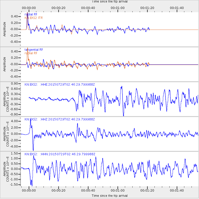
Signal To Noise
| Channel | StoN | STA | LTA |
| KN:EKS2: :HHZ:20150729T02:46:29.799988Z | 50.74711 | 2.2196962E-6 | 4.374035E-8 |
| KN:EKS2: :HHN:20150729T02:46:29.799988Z | 15.655902 | 8.8951293E-7 | 5.6816464E-8 |
| KN:EKS2: :HHE:20150729T02:46:29.799988Z | 8.318652 | 3.5412148E-7 | 4.2569578E-8 |
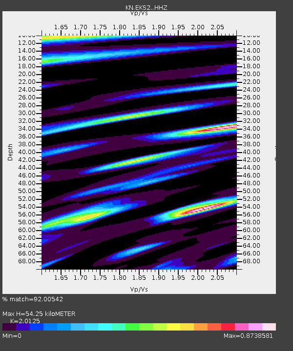
| Arrivals | |
| Ps | 9.0 SECOND |
| PpPs | 25 SECOND |
| PsPs/PpSs | 34 SECOND |

