You are here: Home > Network List > IU - Global Seismograph Network (GSN - IRIS/USGS) Stations List
> Station FURI Mt. Furi, Ethiopia > Earthquake Result Viewer
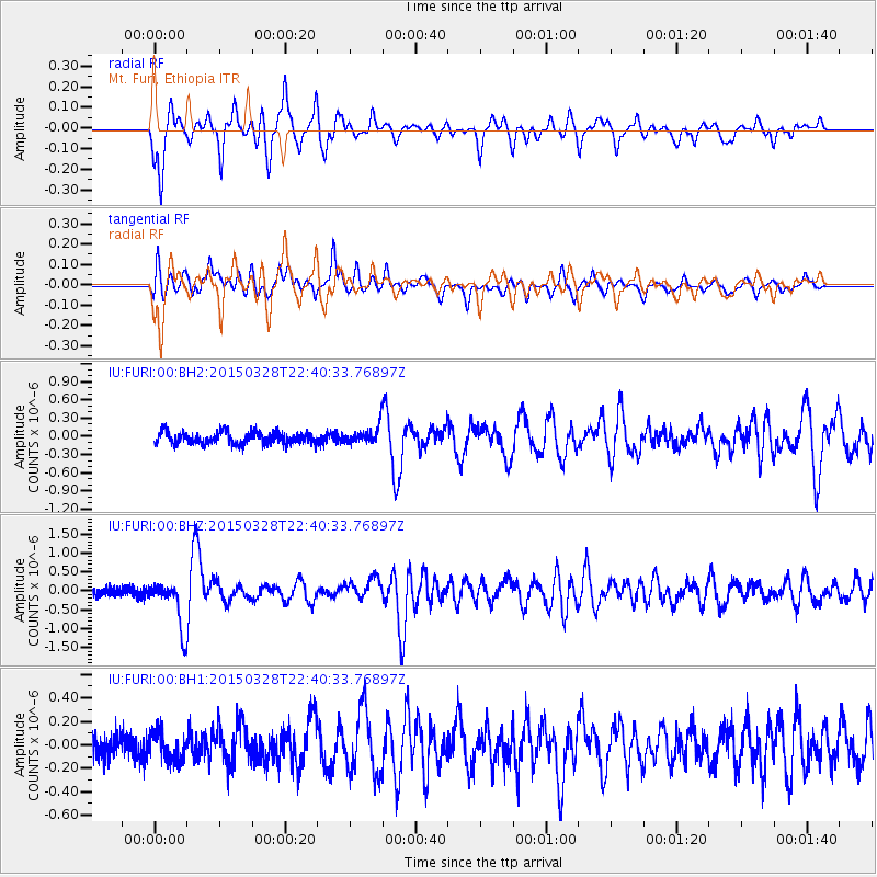
FURI Mt. Furi, Ethiopia - Earthquake Result Viewer
*The percent match for this event was below the threshold and hence no stack was calculated.
| Earthquake location: |
Minahassa Peninsula, Sulawesi |
| Earthquake latitude/longitude: |
0.4/122.0 |
| Earthquake time(UTC): |
2015/03/28 (087) 22:28:51 GMT |
| Earthquake Depth: |
124 km |
| Earthquake Magnitude: |
5.8 MB |
| Earthquake Catalog/Contributor: |
NEIC PDE/NEIC ALERT |
|
| Network: |
IU Global Seismograph Network (GSN - IRIS/USGS) |
| Station: |
FURI Mt. Furi, Ethiopia |
| Lat/Lon: |
8.90 N/38.68 E |
| Elevation: |
2570 m |
|
| Distance: |
83.3 deg |
| Az: |
278.85 deg |
| Baz: |
90.635 deg |
| Ray Param: |
$rayparam |
*The percent match for this event was below the threshold and hence was not used in the summary stack. |
|
| Radial Match: |
76.35102 % |
| Radial Bump: |
400 |
| Transverse Match: |
72.30613 % |
| Transverse Bump: |
400 |
| SOD ConfigId: |
872571 |
| Insert Time: |
2015-04-11 22:37:15.359 +0000 |
| GWidth: |
2.5 |
| Max Bumps: |
400 |
| Tol: |
0.001 |
|
Signal To Noise
| Channel | StoN | STA | LTA |
| IU:FURI:00:BHZ:20150328T22:40:33.76897Z | 5.418764 | 6.4583946E-7 | 1.1918574E-7 |
| IU:FURI:00:BH1:20150328T22:40:33.76897Z | 1.4574789 | 1.2315628E-7 | 8.449954E-8 |
| IU:FURI:00:BH2:20150328T22:40:33.76897Z | 1.4312999 | 1.4449842E-7 | 1.0095608E-7 |
| Arrivals |
| Ps | |
| PpPs | |
| PsPs/PpSs | |


