You are here: Home > Network List > US - United States National Seismic Network Stations List
> Station DGMT Dagmar, Montana, USA > Earthquake Result Viewer
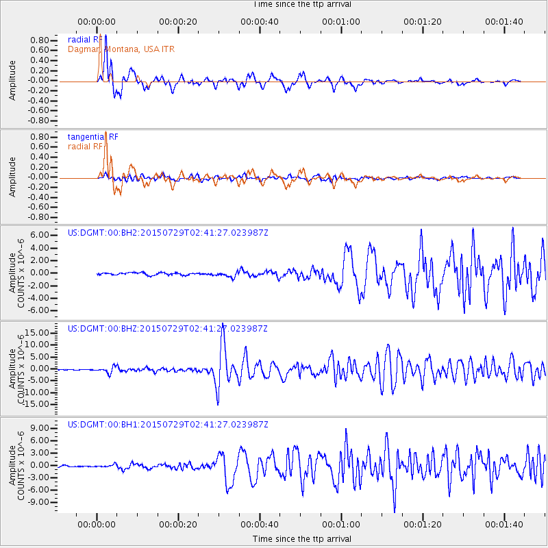
DGMT Dagmar, Montana, USA - Earthquake Result Viewer
*The percent match for this event was below the threshold and hence no stack was calculated.
| Earthquake location: |
Southern Alaska |
| Earthquake latitude/longitude: |
59.9/-153.1 |
| Earthquake time(UTC): |
2015/07/29 (210) 02:35:58 GMT |
| Earthquake Depth: |
118 km |
| Earthquake Magnitude: |
6.3 ML, 6.2 MWP, 6.2 MI, 6.3 MWW |
| Earthquake Catalog/Contributor: |
NEIC PDE/NEIC COMCAT |
|
| Network: |
US United States National Seismic Network |
| Station: |
DGMT Dagmar, Montana, USA |
| Lat/Lon: |
48.47 N/104.20 W |
| Elevation: |
0.0 m |
|
| Distance: |
30.1 deg |
| Az: |
90.202 deg |
| Baz: |
310.761 deg |
| Ray Param: |
$rayparam |
*The percent match for this event was below the threshold and hence was not used in the summary stack. |
|
| Radial Match: |
88.51519 % |
| Radial Bump: |
400 |
| Transverse Match: |
75.64355 % |
| Transverse Bump: |
400 |
| SOD ConfigId: |
7422571 |
| Insert Time: |
2019-04-20 01:51:39.498 +0000 |
| GWidth: |
2.5 |
| Max Bumps: |
400 |
| Tol: |
0.001 |
|
Signal To Noise
| Channel | StoN | STA | LTA |
| US:DGMT:00:BHZ:20150729T02:41:27.023987Z | 12.758296 | 1.2593272E-6 | 9.8706536E-8 |
| US:DGMT:00:BH1:20150729T02:41:27.023987Z | 2.1799593 | 3.71573E-7 | 1.7044951E-7 |
| US:DGMT:00:BH2:20150729T02:41:27.023987Z | 2.1935697 | 4.143057E-7 | 1.8887283E-7 |
| Arrivals |
| Ps | |
| PpPs | |
| PsPs/PpSs | |


