You are here: Home > Network List > TA - USArray Transportable Network (new EarthScope stations) Stations List
> Station O48A Farmland, IN, USA > Earthquake Result Viewer
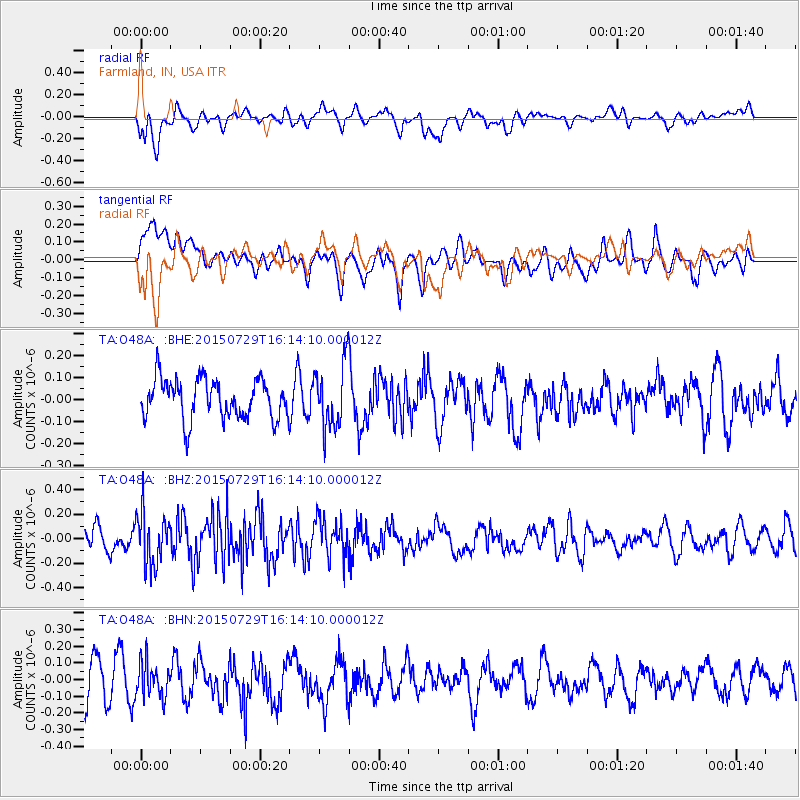
O48A Farmland, IN, USA - Earthquake Result Viewer
*The percent match for this event was below the threshold and hence no stack was calculated.
| Earthquake location: |
Fox Islands, Aleutian Islands |
| Earthquake latitude/longitude: |
52.0/-169.3 |
| Earthquake time(UTC): |
2015/07/29 (210) 16:05:02 GMT |
| Earthquake Depth: |
26 km |
| Earthquake Magnitude: |
5.3 MW |
| Earthquake Catalog/Contributor: |
ISC/ISC |
|
| Network: |
TA USArray Transportable Network (new EarthScope stations) |
| Station: |
O48A Farmland, IN, USA |
| Lat/Lon: |
40.26 N/85.16 W |
| Elevation: |
300 m |
|
| Distance: |
56.3 deg |
| Az: |
66.165 deg |
| Baz: |
312.426 deg |
| Ray Param: |
$rayparam |
*The percent match for this event was below the threshold and hence was not used in the summary stack. |
|
| Radial Match: |
50.800743 % |
| Radial Bump: |
400 |
| Transverse Match: |
50.670288 % |
| Transverse Bump: |
400 |
| SOD ConfigId: |
7422571 |
| Insert Time: |
2019-04-20 02:04:57.329 +0000 |
| GWidth: |
2.5 |
| Max Bumps: |
400 |
| Tol: |
0.001 |
|
Signal To Noise
| Channel | StoN | STA | LTA |
| TA:O48A: :BHZ:20150729T16:14:10.000012Z | 1.9992026 | 2.15227E-7 | 1.07656426E-7 |
| TA:O48A: :BHN:20150729T16:14:10.000012Z | 0.9707921 | 1.03963224E-7 | 1.0709113E-7 |
| TA:O48A: :BHE:20150729T16:14:10.000012Z | 1.6303687 | 1.4588501E-7 | 8.947976E-8 |
| Arrivals |
| Ps | |
| PpPs | |
| PsPs/PpSs | |


