You are here: Home > Network List > WY - Yellowstone Wyoming Seismic Network Stations List
> Station YUF Upper Falls, WY, USA > Earthquake Result Viewer
YUF Upper Falls, WY, USA - Earthquake Result Viewer

| Earthquake location: |
Ecuador |
| Earthquake latitude/longitude: |
-1.2/-77.6 |
| Earthquake time(UTC): |
2015/03/27 (086) 21:59:39 GMT |
| Earthquake Depth: |
195 km |
| Earthquake Magnitude: |
5.5 MWW, 5.5 MWB |
| Earthquake Catalog/Contributor: |
NEIC PDE/NEIC COMCAT |
|
| Network: |
WY Yellowstone Wyoming Seismic Network |
| Station: |
YUF Upper Falls, WY, USA |
| Lat/Lon: |
44.71 N/110.51 W |
| Elevation: |
2394 m |
|
| Distance: |
54.3 deg |
| Az: |
331.488 deg |
| Baz: |
137.984 deg |
| Ray Param: |
0.06487364 |
| Estimated Moho Depth: |
12.75 km |
| Estimated Crust Vp/Vs: |
1.99 |
| Assumed Crust Vp: |
6.35 km/s |
| Estimated Crust Vs: |
3.199 km/s |
| Estimated Crust Poisson's Ratio: |
0.33 |
|
| Radial Match: |
96.65899 % |
| Radial Bump: |
150 |
| Transverse Match: |
86.64086 % |
| Transverse Bump: |
400 |
| SOD ConfigId: |
872571 |
| Insert Time: |
2015-04-12 06:13:51.487 +0000 |
| GWidth: |
2.5 |
| Max Bumps: |
400 |
| Tol: |
0.001 |
|
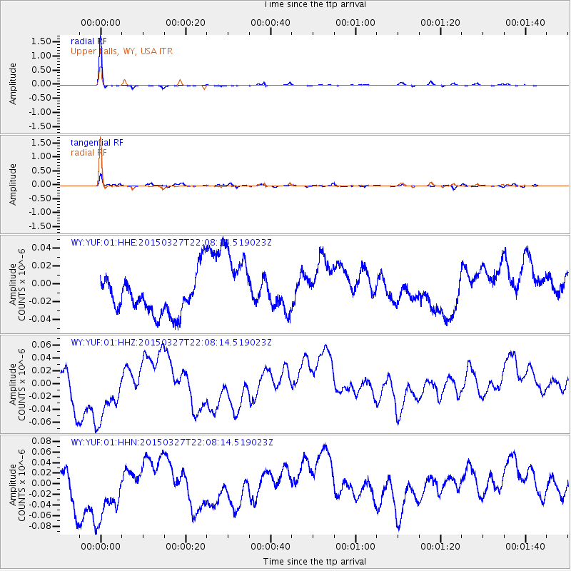
Signal To Noise
| Channel | StoN | STA | LTA |
| WY:YUF:01:HHZ:20150327T22:08:14.519023Z | 1.8801953 | 5.725777E-8 | 3.0453094E-8 |
| WY:YUF:01:HHN:20150327T22:08:14.519023Z | 1.8081939 | 6.792128E-8 | 3.7563048E-8 |
| WY:YUF:01:HHE:20150327T22:08:14.519023Z | 2.0306623 | 4.266438E-8 | 2.101008E-8 |
| Arrivals |
| Ps | 2.1 SECOND |
| PpPs | 5.7 SECOND |
| PsPs/PpSs | 7.8 SECOND |


