You are here: Home > Network List > UW - Pacific Northwest Regional Seismic Network Stations List
> Station UMAT Pilot Rock, OR, USA > Earthquake Result Viewer
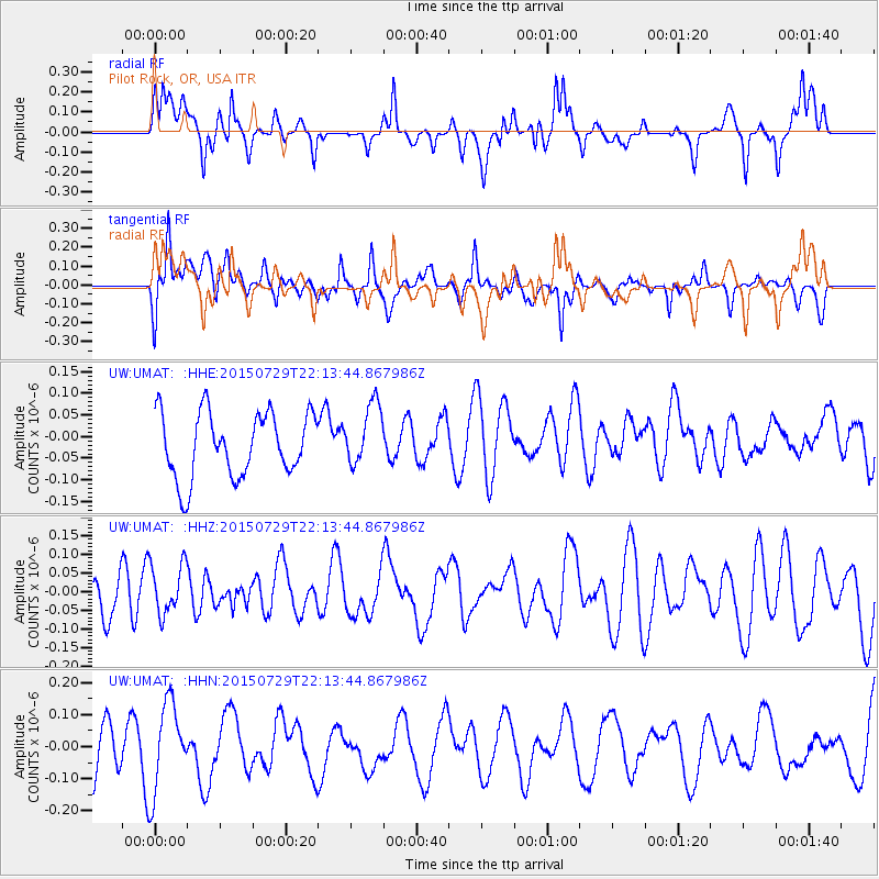
UMAT Pilot Rock, OR, USA - Earthquake Result Viewer
*The percent match for this event was below the threshold and hence no stack was calculated.
| Earthquake location: |
Turkey |
| Earthquake latitude/longitude: |
36.5/35.0 |
| Earthquake time(UTC): |
2015/07/29 (210) 22:00:55 GMT |
| Earthquake Depth: |
32 km |
| Earthquake Magnitude: |
5.0 MW |
| Earthquake Catalog/Contributor: |
ISC/ISC |
|
| Network: |
UW Pacific Northwest Regional Seismic Network |
| Station: |
UMAT Pilot Rock, OR, USA |
| Lat/Lon: |
45.29 N/118.96 W |
| Elevation: |
1318 m |
|
| Distance: |
95.2 deg |
| Az: |
341.846 deg |
| Baz: |
20.827 deg |
| Ray Param: |
$rayparam |
*The percent match for this event was below the threshold and hence was not used in the summary stack. |
|
| Radial Match: |
55.56522 % |
| Radial Bump: |
400 |
| Transverse Match: |
65.69543 % |
| Transverse Bump: |
400 |
| SOD ConfigId: |
7422571 |
| Insert Time: |
2019-04-20 02:12:37.005 +0000 |
| GWidth: |
2.5 |
| Max Bumps: |
400 |
| Tol: |
0.001 |
|
Signal To Noise
| Channel | StoN | STA | LTA |
| UW:UMAT: :HHZ:20150729T22:13:44.867986Z | 0.8751857 | 6.684542E-8 | 7.637856E-8 |
| UW:UMAT: :HHN:20150729T22:13:44.867986Z | 2.169999 | 1.3751777E-7 | 6.3372276E-8 |
| UW:UMAT: :HHE:20150729T22:13:44.867986Z | 0.96851784 | 7.2481335E-8 | 7.483738E-8 |
| Arrivals |
| Ps | |
| PpPs | |
| PsPs/PpSs | |


