You are here: Home > Network List > AV - Alaska Volcano Observatory Stations List
> Station MAPS Pakushin Southeast, Makushin Volcano, Alaska > Earthquake Result Viewer
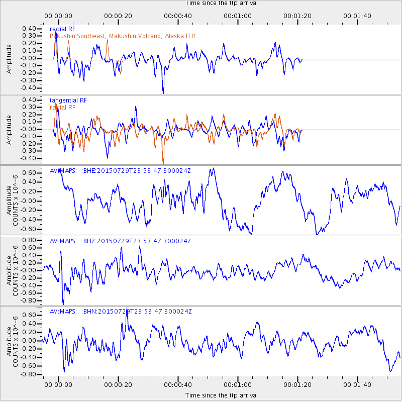
MAPS Pakushin Southeast, Makushin Volcano, Alaska - Earthquake Result Viewer
*The percent match for this event was below the threshold and hence no stack was calculated.
| Earthquake location: |
Near East Coast Of Australia |
| Earthquake latitude/longitude: |
-25.4/154.2 |
| Earthquake time(UTC): |
2015/07/29 (210) 23:41:40 GMT |
| Earthquake Depth: |
10 km |
| Earthquake Magnitude: |
5.7 MB |
| Earthquake Catalog/Contributor: |
NEIC PDE/NEIC ALERT |
|
| Network: |
AV Alaska Volcano Observatory |
| Station: |
MAPS Pakushin Southeast, Makushin Volcano, Alaska |
| Lat/Lon: |
53.81 N/166.94 W |
| Elevation: |
333 m |
|
| Distance: |
85.8 deg |
| Az: |
21.9 deg |
| Baz: |
214.658 deg |
| Ray Param: |
$rayparam |
*The percent match for this event was below the threshold and hence was not used in the summary stack. |
|
| Radial Match: |
51.29155 % |
| Radial Bump: |
288 |
| Transverse Match: |
29.151417 % |
| Transverse Bump: |
266 |
| SOD ConfigId: |
7422571 |
| Insert Time: |
2019-04-20 02:14:58.906 +0000 |
| GWidth: |
2.5 |
| Max Bumps: |
400 |
| Tol: |
0.001 |
|
Signal To Noise
| Channel | StoN | STA | LTA |
| AV:MAPS: :BHZ:20150729T23:53:47.300024Z | 5.275081 | 4.589427E-7 | 8.7002014E-8 |
| AV:MAPS: :BHN:20150729T23:53:47.300024Z | 1.9240087 | 3.5223587E-7 | 1.8307395E-7 |
| AV:MAPS: :BHE:20150729T23:53:47.300024Z | 1.1687797 | 2.8070312E-7 | 2.4016768E-7 |
| Arrivals |
| Ps | |
| PpPs | |
| PsPs/PpSs | |


