You are here: Home > Network List > AV - Alaska Volcano Observatory Stations List
> Station SPCR Ckakachatna River, Mount Spurr, Alaska > Earthquake Result Viewer
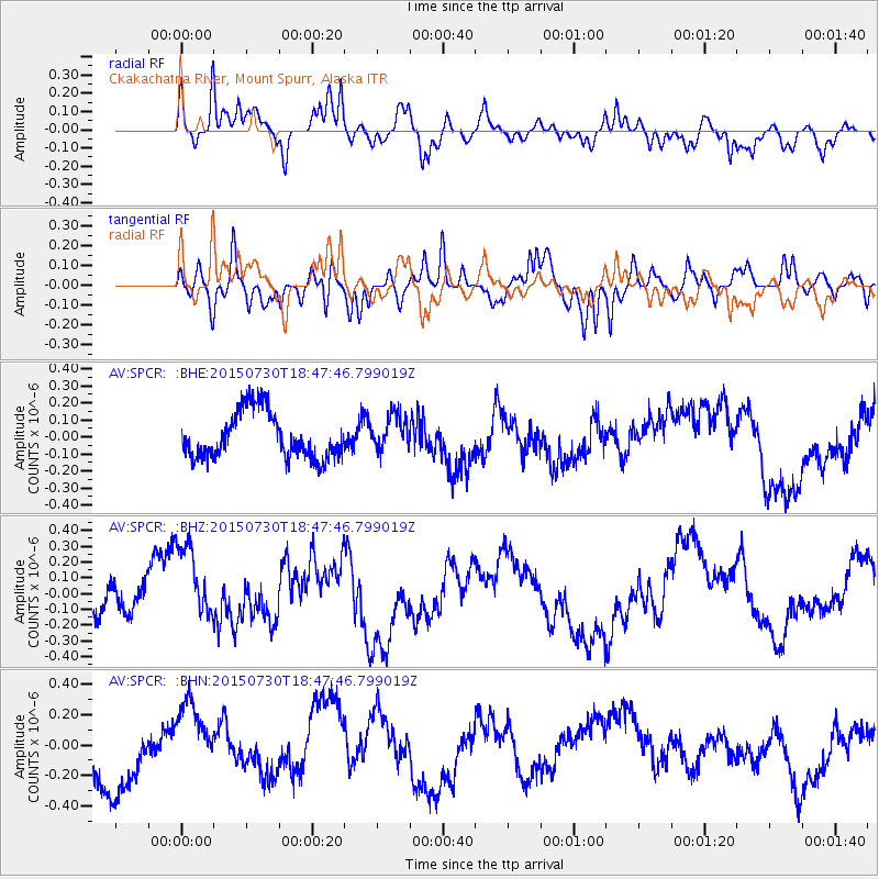
SPCR Ckakachatna River, Mount Spurr, Alaska - Earthquake Result Viewer
*The percent match for this event was below the threshold and hence no stack was calculated.
| Earthquake location: |
Kermadec Islands Region |
| Earthquake latitude/longitude: |
-27.2/-176.2 |
| Earthquake time(UTC): |
2015/07/30 (211) 18:35:17 GMT |
| Earthquake Depth: |
12 km |
| Earthquake Magnitude: |
5.5 MW |
| Earthquake Catalog/Contributor: |
ISC/ISC |
|
| Network: |
AV Alaska Volcano Observatory |
| Station: |
SPCR Ckakachatna River, Mount Spurr, Alaska |
| Lat/Lon: |
61.20 N/152.21 W |
| Elevation: |
984 m |
|
| Distance: |
90.3 deg |
| Az: |
11.337 deg |
| Baz: |
201.188 deg |
| Ray Param: |
$rayparam |
*The percent match for this event was below the threshold and hence was not used in the summary stack. |
|
| Radial Match: |
57.550373 % |
| Radial Bump: |
400 |
| Transverse Match: |
65.431305 % |
| Transverse Bump: |
400 |
| SOD ConfigId: |
7422571 |
| Insert Time: |
2019-04-20 02:25:20.492 +0000 |
| GWidth: |
2.5 |
| Max Bumps: |
400 |
| Tol: |
0.001 |
|
Signal To Noise
| Channel | StoN | STA | LTA |
| AV:SPCR: :BHZ:20150730T18:47:46.799019Z | 2.5460238 | 2.6655366E-7 | 1.0469409E-7 |
| AV:SPCR: :BHN:20150730T18:47:46.799019Z | 0.93835235 | 2.2691401E-7 | 2.4182174E-7 |
| AV:SPCR: :BHE:20150730T18:47:46.799019Z | 0.76836604 | 1.03201664E-7 | 1.3431314E-7 |
| Arrivals |
| Ps | |
| PpPs | |
| PsPs/PpSs | |


