You are here: Home > Network List > WY - Yellowstone Wyoming Seismic Network Stations List
> Station YHH Holmes Hill, YNP, WY, USA > Earthquake Result Viewer
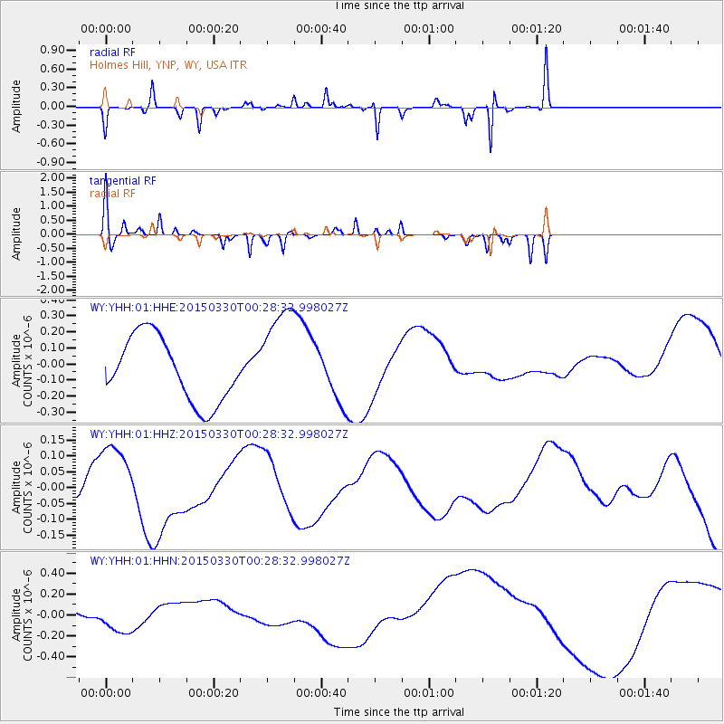
YHH Holmes Hill, YNP, WY, USA - Earthquake Result Viewer
*The percent match for this event was below the threshold and hence no stack was calculated.
| Earthquake location: |
New Britain Region, P.N.G. |
| Earthquake latitude/longitude: |
-5.2/152.6 |
| Earthquake time(UTC): |
2015/03/30 (089) 00:15:30 GMT |
| Earthquake Depth: |
35 km |
| Earthquake Magnitude: |
5.7 MB |
| Earthquake Catalog/Contributor: |
NEIC PDE/NEIC COMCAT |
|
| Network: |
WY Yellowstone Wyoming Seismic Network |
| Station: |
YHH Holmes Hill, YNP, WY, USA |
| Lat/Lon: |
44.79 N/110.85 W |
| Elevation: |
2717 m |
|
| Distance: |
98.3 deg |
| Az: |
45.632 deg |
| Baz: |
270.917 deg |
| Ray Param: |
$rayparam |
*The percent match for this event was below the threshold and hence was not used in the summary stack. |
|
| Radial Match: |
35.07165 % |
| Radial Bump: |
104 |
| Transverse Match: |
62.650772 % |
| Transverse Bump: |
220 |
| SOD ConfigId: |
872571 |
| Insert Time: |
2015-04-13 00:38:29.918 +0000 |
| GWidth: |
2.5 |
| Max Bumps: |
400 |
| Tol: |
0.001 |
|
Signal To Noise
| Channel | StoN | STA | LTA |
| WY:YHH:01:HHZ:20150330T00:28:32.998027Z | 1.4203135 | 1.3324151E-7 | 9.3811344E-8 |
| WY:YHH:01:HHN:20150330T00:28:32.998027Z | 1.7869575 | 1.3303554E-7 | 7.4448074E-8 |
| WY:YHH:01:HHE:20150330T00:28:32.998027Z | 1.573842 | 3.1701703E-7 | 2.0142875E-7 |
| Arrivals |
| Ps | |
| PpPs | |
| PsPs/PpSs | |


