You are here: Home > Network List > GS - US Geological Survey Networks Stations List
> Station KAN11 Stewart Ranch, Harper County, KS, USA > Earthquake Result Viewer
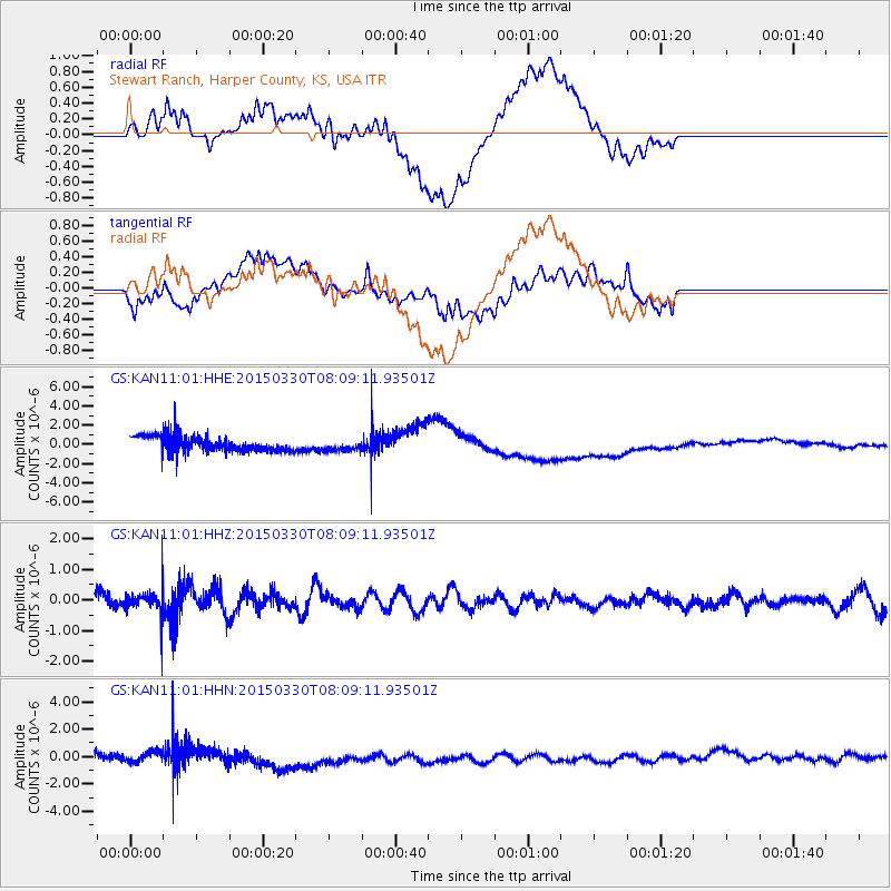
KAN11 Stewart Ranch, Harper County, KS, USA - Earthquake Result Viewer
*The percent match for this event was below the threshold and hence no stack was calculated.
| Earthquake location: |
Tonga Islands |
| Earthquake latitude/longitude: |
-15.4/-173.1 |
| Earthquake time(UTC): |
2015/03/30 (089) 07:56:54 GMT |
| Earthquake Depth: |
10 km |
| Earthquake Magnitude: |
5.6 MB |
| Earthquake Catalog/Contributor: |
NEIC PDE/NEIC COMCAT |
|
| Network: |
GS US Geological Survey Networks |
| Station: |
KAN11 Stewart Ranch, Harper County, KS, USA |
| Lat/Lon: |
37.21 N/97.91 W |
| Elevation: |
410 m |
|
| Distance: |
87.8 deg |
| Az: |
50.571 deg |
| Baz: |
248.901 deg |
| Ray Param: |
$rayparam |
*The percent match for this event was below the threshold and hence was not used in the summary stack. |
|
| Radial Match: |
14.777399 % |
| Radial Bump: |
400 |
| Transverse Match: |
25.235868 % |
| Transverse Bump: |
400 |
| SOD ConfigId: |
872571 |
| Insert Time: |
2015-04-13 08:16:08.709 +0000 |
| GWidth: |
2.5 |
| Max Bumps: |
400 |
| Tol: |
0.001 |
|
Signal To Noise
| Channel | StoN | STA | LTA |
| GS:KAN11:01:HHZ:20150330T08:09:11.93501Z | 1.0738953 | 3.5633428E-7 | 3.3181473E-7 |
| GS:KAN11:01:HHN:20150330T08:09:11.93501Z | 0.4215483 | 3.7417126E-7 | 8.876118E-7 |
| GS:KAN11:01:HHE:20150330T08:09:11.93501Z | 0.67148834 | 5.611268E-7 | 8.356464E-7 |
| Arrivals |
| Ps | |
| PpPs | |
| PsPs/PpSs | |


