You are here: Home > Network List > WY - Yellowstone Wyoming Seismic Network Stations List
> Station YUF Upper Falls, WY, USA > Earthquake Result Viewer
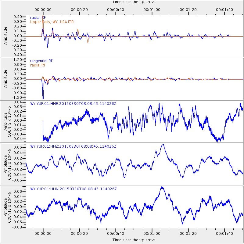
YUF Upper Falls, WY, USA - Earthquake Result Viewer
*The percent match for this event was below the threshold and hence no stack was calculated.
| Earthquake location: |
Tonga Islands |
| Earthquake latitude/longitude: |
-15.4/-173.1 |
| Earthquake time(UTC): |
2015/03/30 (089) 07:56:54 GMT |
| Earthquake Depth: |
10 km |
| Earthquake Magnitude: |
5.6 MB |
| Earthquake Catalog/Contributor: |
NEIC PDE/NEIC COMCAT |
|
| Network: |
WY Yellowstone Wyoming Seismic Network |
| Station: |
YUF Upper Falls, WY, USA |
| Lat/Lon: |
44.71 N/110.51 W |
| Elevation: |
2394 m |
|
| Distance: |
82.5 deg |
| Az: |
39.675 deg |
| Baz: |
239.712 deg |
| Ray Param: |
$rayparam |
*The percent match for this event was below the threshold and hence was not used in the summary stack. |
|
| Radial Match: |
56.275402 % |
| Radial Bump: |
400 |
| Transverse Match: |
90.49317 % |
| Transverse Bump: |
400 |
| SOD ConfigId: |
872571 |
| Insert Time: |
2015-04-13 08:23:00.122 +0000 |
| GWidth: |
2.5 |
| Max Bumps: |
400 |
| Tol: |
0.001 |
|
Signal To Noise
| Channel | StoN | STA | LTA |
| WY:YUF:01:HHZ:20150330T08:08:45.114026Z | 0.75694746 | 1.5527025E-8 | 2.0512685E-8 |
| WY:YUF:01:HHN:20150330T08:08:45.114026Z | 0.7315947 | 1.5433466E-8 | 2.1095651E-8 |
| WY:YUF:01:HHE:20150330T08:08:45.114026Z | 0.97418857 | 1.664045E-8 | 1.7081344E-8 |
| Arrivals |
| Ps | |
| PpPs | |
| PsPs/PpSs | |


