You are here: Home > Network List > US - United States National Seismic Network Stations List
> Station MSO Missoula, Montana, USA > Earthquake Result Viewer
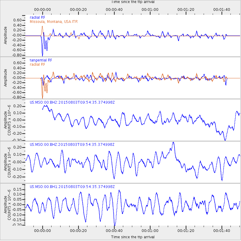
MSO Missoula, Montana, USA - Earthquake Result Viewer
*The percent match for this event was below the threshold and hence no stack was calculated.
| Earthquake location: |
Solomon Islands |
| Earthquake latitude/longitude: |
-10.8/161.9 |
| Earthquake time(UTC): |
2015/08/03 (215) 09:41:52 GMT |
| Earthquake Depth: |
31 km |
| Earthquake Magnitude: |
5.3 MW |
| Earthquake Catalog/Contributor: |
ISC/ISC |
|
| Network: |
US United States National Seismic Network |
| Station: |
MSO Missoula, Montana, USA |
| Lat/Lon: |
46.83 N/113.94 W |
| Elevation: |
1264 m |
|
| Distance: |
93.8 deg |
| Az: |
43.204 deg |
| Baz: |
258.436 deg |
| Ray Param: |
$rayparam |
*The percent match for this event was below the threshold and hence was not used in the summary stack. |
|
| Radial Match: |
82.69724 % |
| Radial Bump: |
383 |
| Transverse Match: |
50.124214 % |
| Transverse Bump: |
386 |
| SOD ConfigId: |
7422571 |
| Insert Time: |
2019-04-20 03:17:14.119 +0000 |
| GWidth: |
2.5 |
| Max Bumps: |
400 |
| Tol: |
0.001 |
|
Signal To Noise
| Channel | StoN | STA | LTA |
| US:MSO:00:BHZ:20150803T09:54:35.374998Z | 0.8006752 | 5.3713514E-8 | 6.7085274E-8 |
| US:MSO:00:BH1:20150803T09:54:35.374998Z | 0.99361724 | 4.213388E-8 | 4.2404537E-8 |
| US:MSO:00:BH2:20150803T09:54:35.374998Z | 1.0122513 | 8.79827E-8 | 8.6917844E-8 |
| Arrivals |
| Ps | |
| PpPs | |
| PsPs/PpSs | |


