You are here: Home > Network List > UW - Pacific Northwest Regional Seismic Network Stations List
> Station UMAT Pilot Rock, OR, USA > Earthquake Result Viewer
UMAT Pilot Rock, OR, USA - Earthquake Result Viewer
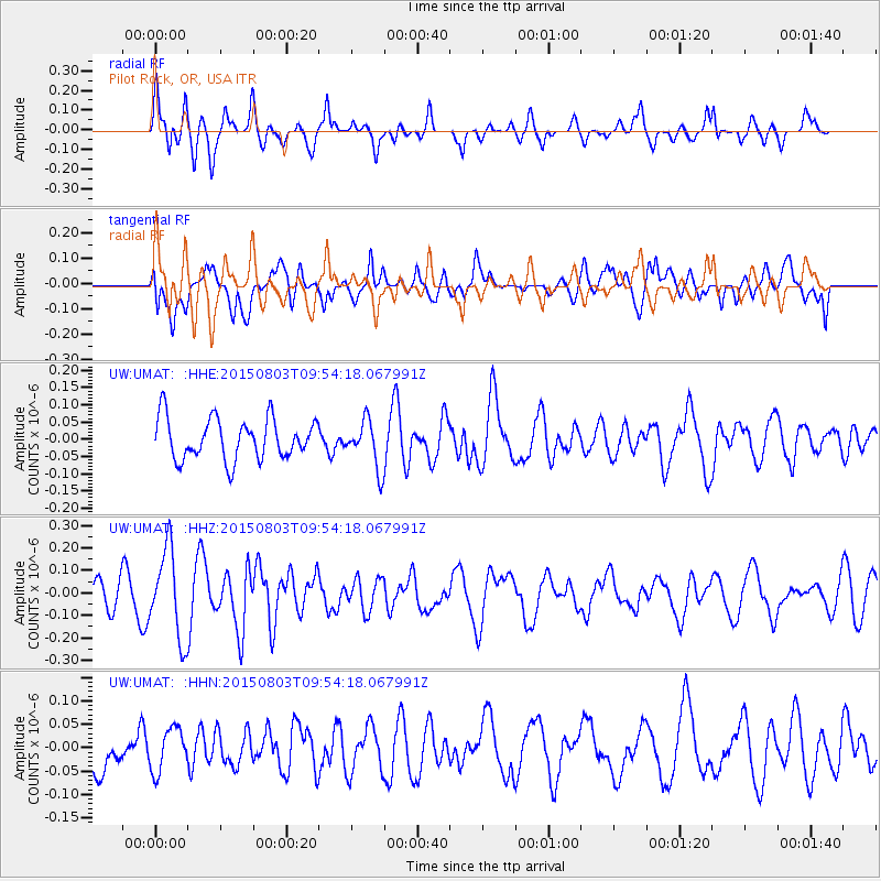
*The percent match for this event was below the threshold and hence no stack was calculated.
| Earthquake location: |
Solomon Islands |
| Earthquake latitude/longitude: |
-10.8/161.9 |
| Earthquake time(UTC): |
2015/08/03 (215) 09:41:52 GMT |
| Earthquake Depth: |
31 km |
| Earthquake Magnitude: |
5.3 MW |
| Earthquake Catalog/Contributor: |
ISC/ISC |
|
| Network: |
UW Pacific Northwest Regional Seismic Network |
| Station: |
UMAT Pilot Rock, OR, USA |
| Lat/Lon: |
45.29 N/118.96 W |
| Elevation: |
1318 m |
|
| Distance: |
90.1 deg |
| Az: |
43.891 deg |
| Baz: |
254.809 deg |
| Ray Param: |
$rayparam |
*The percent match for this event was below the threshold and hence was not used in the summary stack. |
|
| Radial Match: |
56.719025 % |
| Radial Bump: |
400 |
| Transverse Match: |
58.626602 % |
| Transverse Bump: |
400 |
| SOD ConfigId: |
7422571 |
| Insert Time: |
2019-04-20 03:17:29.615 +0000 |
| GWidth: |
2.5 |
| Max Bumps: |
400 |
| Tol: |
0.001 |
|
Signal To Noise
| Channel | StoN | STA | LTA |
| UW:UMAT: :HHZ:20150803T09:54:18.067991Z | 2.7138247 | 1.9521242E-7 | 7.193258E-8 |
| UW:UMAT: :HHN:20150803T09:54:18.067991Z | 0.7649982 | 4.5994227E-8 | 6.012331E-8 |
| UW:UMAT: :HHE:20150803T09:54:18.067991Z | 1.1727651 | 6.973027E-8 | 5.9458E-8 |
| Arrivals |
| Ps | |
| PpPs | |
| PsPs/PpSs | |


