You are here: Home > Network List > GS - US Geological Survey Networks Stations List
> Station KAN10 Keim Farm, Anthony, KS, USA > Earthquake Result Viewer
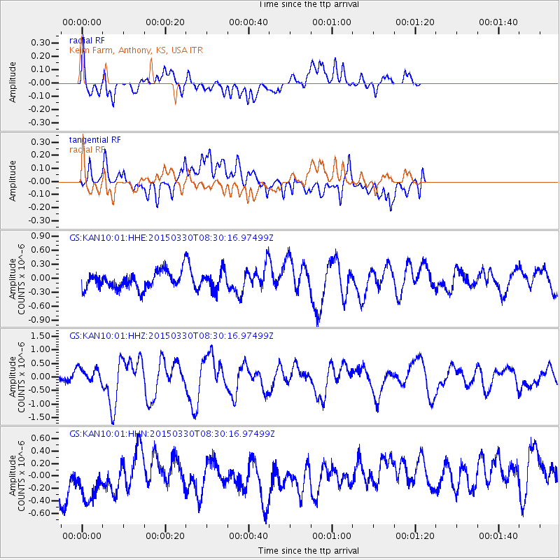
KAN10 Keim Farm, Anthony, KS, USA - Earthquake Result Viewer
*The percent match for this event was below the threshold and hence no stack was calculated.
| Earthquake location: |
Samoa Islands Region |
| Earthquake latitude/longitude: |
-15.4/-172.9 |
| Earthquake time(UTC): |
2015/03/30 (089) 08:18:00 GMT |
| Earthquake Depth: |
10 km |
| Earthquake Magnitude: |
6.8 MWP, 6.8 MI |
| Earthquake Catalog/Contributor: |
NEIC PDE/NEIC COMCAT |
|
| Network: |
GS US Geological Survey Networks |
| Station: |
KAN10 Keim Farm, Anthony, KS, USA |
| Lat/Lon: |
37.12 N/98.10 W |
| Elevation: |
417 m |
|
| Distance: |
87.5 deg |
| Az: |
50.543 deg |
| Baz: |
248.703 deg |
| Ray Param: |
$rayparam |
*The percent match for this event was below the threshold and hence was not used in the summary stack. |
|
| Radial Match: |
61.61915 % |
| Radial Bump: |
400 |
| Transverse Match: |
39.12114 % |
| Transverse Bump: |
400 |
| SOD ConfigId: |
872571 |
| Insert Time: |
2015-04-13 08:26:09.001 +0000 |
| GWidth: |
2.5 |
| Max Bumps: |
400 |
| Tol: |
0.001 |
|
Signal To Noise
| Channel | StoN | STA | LTA |
| GS:KAN10:01:HHZ:20150330T08:30:16.97499Z | 2.022839 | 2.8852708E-7 | 1.4263472E-7 |
| GS:KAN10:01:HHN:20150330T08:30:16.97499Z | 1.1373417 | 6.210824E-7 | 5.460825E-7 |
| GS:KAN10:01:HHE:20150330T08:30:16.97499Z | 1.1137532 | 1.9935378E-7 | 1.7899276E-7 |
| Arrivals |
| Ps | |
| PpPs | |
| PsPs/PpSs | |


