You are here: Home > Network List > AV - Alaska Volcano Observatory Stations List
> Station MAPS Pakushin Southeast, Makushin Volcano, Alaska > Earthquake Result Viewer
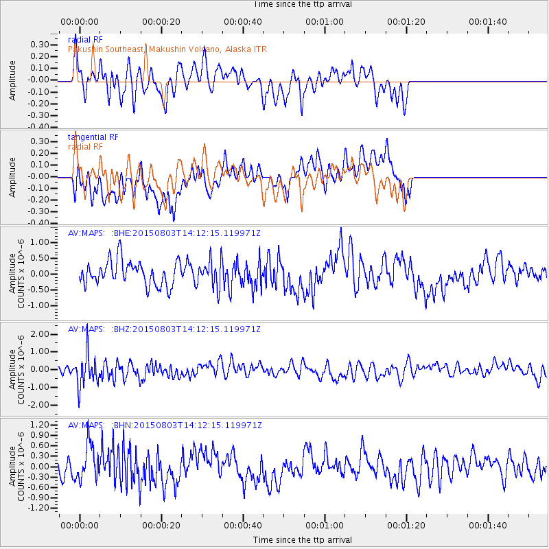
MAPS Pakushin Southeast, Makushin Volcano, Alaska - Earthquake Result Viewer
*The percent match for this event was below the threshold and hence no stack was calculated.
| Earthquake location: |
Tonga Islands |
| Earthquake latitude/longitude: |
-16.5/-174.3 |
| Earthquake time(UTC): |
2015/08/03 (215) 14:01:51 GMT |
| Earthquake Depth: |
162 km |
| Earthquake Magnitude: |
5.7 MWB, 5.7 MWW |
| Earthquake Catalog/Contributor: |
NEIC PDE/NEIC COMCAT |
|
| Network: |
AV Alaska Volcano Observatory |
| Station: |
MAPS Pakushin Southeast, Makushin Volcano, Alaska |
| Lat/Lon: |
53.81 N/166.94 W |
| Elevation: |
333 m |
|
| Distance: |
70.3 deg |
| Az: |
4.653 deg |
| Baz: |
187.542 deg |
| Ray Param: |
$rayparam |
*The percent match for this event was below the threshold and hence was not used in the summary stack. |
|
| Radial Match: |
50.560356 % |
| Radial Bump: |
400 |
| Transverse Match: |
60.156033 % |
| Transverse Bump: |
400 |
| SOD ConfigId: |
7422571 |
| Insert Time: |
2019-04-20 03:25:33.408 +0000 |
| GWidth: |
2.5 |
| Max Bumps: |
400 |
| Tol: |
0.001 |
|
Signal To Noise
| Channel | StoN | STA | LTA |
| AV:MAPS: :BHZ:20150803T14:12:15.119971Z | 3.8991065 | 9.2826764E-7 | 2.3807189E-7 |
| AV:MAPS: :BHN:20150803T14:12:15.119971Z | 1.3889632 | 5.1615365E-7 | 3.7161072E-7 |
| AV:MAPS: :BHE:20150803T14:12:15.119971Z | 1.1363689 | 4.332044E-7 | 3.8121811E-7 |
| Arrivals |
| Ps | |
| PpPs | |
| PsPs/PpSs | |


