You are here: Home > Network List > US - United States National Seismic Network Stations List
> Station MSO Missoula, Montana, USA > Earthquake Result Viewer
MSO Missoula, Montana, USA - Earthquake Result Viewer
*The percent match for this event was below the threshold and hence no stack was calculated.
| Earthquake location: |
Samoa Islands Region |
| Earthquake latitude/longitude: |
-15.4/-172.9 |
| Earthquake time(UTC): |
2015/03/30 (089) 08:18:00 GMT |
| Earthquake Depth: |
10 km |
| Earthquake Magnitude: |
6.8 MWP, 6.8 MI |
| Earthquake Catalog/Contributor: |
NEIC PDE/NEIC COMCAT |
|
| Network: |
US United States National Seismic Network |
| Station: |
MSO Missoula, Montana, USA |
| Lat/Lon: |
46.83 N/113.94 W |
| Elevation: |
1264 m |
|
| Distance: |
81.4 deg |
| Az: |
36.516 deg |
| Baz: |
236.707 deg |
| Ray Param: |
$rayparam |
*The percent match for this event was below the threshold and hence was not used in the summary stack. |
|
| Radial Match: |
55.897366 % |
| Radial Bump: |
400 |
| Transverse Match: |
28.475647 % |
| Transverse Bump: |
370 |
| SOD ConfigId: |
872571 |
| Insert Time: |
2015-04-13 08:29:53.876 +0000 |
| GWidth: |
2.5 |
| Max Bumps: |
400 |
| Tol: |
0.001 |
|
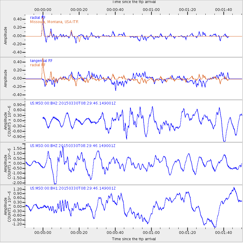
Signal To Noise
| Channel | StoN | STA | LTA |
| US:MSO:00:BHZ:20150330T08:29:46.149001Z | 3.5368917 | 5.565475E-7 | 1.5735498E-7 |
| US:MSO:00:BH1:20150330T08:29:46.149001Z | 0.6154826 | 8.3736275E-8 | 1.3604979E-7 |
| US:MSO:00:BH2:20150330T08:29:46.149001Z | 1.0928472 | 2.2323958E-7 | 2.0427338E-7 |
| Arrivals |
| Ps | |
| PpPs | |
| PsPs/PpSs | |


