You are here: Home > Network List > GS - US Geological Survey Networks Stations List
> Station DEC09 Decatur Surface Seismic Site, Decatur, IL, USA > Earthquake Result Viewer
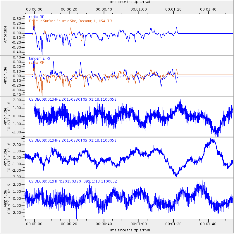
DEC09 Decatur Surface Seismic Site, Decatur, IL, USA - Earthquake Result Viewer
*The percent match for this event was below the threshold and hence no stack was calculated.
| Earthquake location: |
Samoa Islands Region |
| Earthquake latitude/longitude: |
-15.5/-172.9 |
| Earthquake time(UTC): |
2015/03/30 (089) 08:48:25 GMT |
| Earthquake Depth: |
10 km |
| Earthquake Magnitude: |
6.8 MWB |
| Earthquake Catalog/Contributor: |
NEIC PDE/NEIC COMCAT |
|
| Network: |
GS US Geological Survey Networks |
| Station: |
DEC09 Decatur Surface Seismic Site, Decatur, IL, USA |
| Lat/Lon: |
39.87 N/88.92 W |
| Elevation: |
207 m |
|
| Distance: |
95.3 deg |
| Az: |
50.232 deg |
| Baz: |
254.304 deg |
| Ray Param: |
$rayparam |
*The percent match for this event was below the threshold and hence was not used in the summary stack. |
|
| Radial Match: |
83.06359 % |
| Radial Bump: |
400 |
| Transverse Match: |
57.12783 % |
| Transverse Bump: |
400 |
| SOD ConfigId: |
872571 |
| Insert Time: |
2015-04-13 09:06:55.838 +0000 |
| GWidth: |
2.5 |
| Max Bumps: |
400 |
| Tol: |
0.001 |
|
Signal To Noise
| Channel | StoN | STA | LTA |
| GS:DEC09:01:HHZ:20150330T09:01:18.110005Z | 0.75357455 | 4.5646362E-7 | 6.057312E-7 |
| GS:DEC09:01:HHN:20150330T09:01:18.110005Z | 0.9701166 | 6.2792844E-7 | 6.4727107E-7 |
| GS:DEC09:01:HHE:20150330T09:01:18.110005Z | 0.84307855 | 5.748003E-7 | 6.8178736E-7 |
| Arrivals |
| Ps | |
| PpPs | |
| PsPs/PpSs | |


