You are here: Home > Network List > CN - Canadian National Seismograph Network Stations List
> Station INK INUVIK, NT > Earthquake Result Viewer
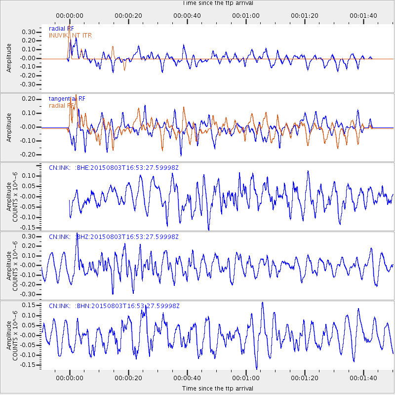
INK INUVIK, NT - Earthquake Result Viewer
*The percent match for this event was below the threshold and hence no stack was calculated.
| Earthquake location: |
New Britain Region, P.N.G. |
| Earthquake latitude/longitude: |
-5.2/152.6 |
| Earthquake time(UTC): |
2015/08/03 (215) 16:41:08 GMT |
| Earthquake Depth: |
38 km |
| Earthquake Magnitude: |
5.2 MW |
| Earthquake Catalog/Contributor: |
ISC/ISC |
|
| Network: |
CN Canadian National Seismograph Network |
| Station: |
INK INUVIK, NT |
| Lat/Lon: |
68.31 N/133.53 W |
| Elevation: |
44 m |
|
| Distance: |
88.9 deg |
| Az: |
20.931 deg |
| Baz: |
253.126 deg |
| Ray Param: |
$rayparam |
*The percent match for this event was below the threshold and hence was not used in the summary stack. |
|
| Radial Match: |
56.206093 % |
| Radial Bump: |
400 |
| Transverse Match: |
51.64056 % |
| Transverse Bump: |
400 |
| SOD ConfigId: |
7422571 |
| Insert Time: |
2019-04-20 03:36:23.840 +0000 |
| GWidth: |
2.5 |
| Max Bumps: |
400 |
| Tol: |
0.001 |
|
Signal To Noise
| Channel | StoN | STA | LTA |
| CN:INK: :BHZ:20150803T16:53:27.59998Z | 2.016842 | 1.3958737E-7 | 6.921087E-8 |
| CN:INK: :BHN:20150803T16:53:27.59998Z | 1.0664414 | 5.751122E-8 | 5.3928154E-8 |
| CN:INK: :BHE:20150803T16:53:27.59998Z | 1.3709986 | 5.748936E-8 | 4.193247E-8 |
| Arrivals |
| Ps | |
| PpPs | |
| PsPs/PpSs | |


