You are here: Home > Network List > TA - USArray Transportable Network (new EarthScope stations) Stations List
> Station J20K Nowitna River, AK, USA > Earthquake Result Viewer
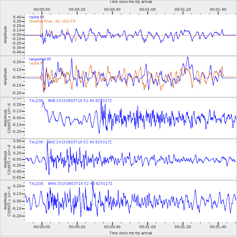
J20K Nowitna River, AK, USA - Earthquake Result Viewer
*The percent match for this event was below the threshold and hence no stack was calculated.
| Earthquake location: |
New Britain Region, P.N.G. |
| Earthquake latitude/longitude: |
-5.2/152.6 |
| Earthquake time(UTC): |
2015/08/03 (215) 16:41:08 GMT |
| Earthquake Depth: |
38 km |
| Earthquake Magnitude: |
5.2 MW |
| Earthquake Catalog/Contributor: |
ISC/ISC |
|
| Network: |
TA USArray Transportable Network (new EarthScope stations) |
| Station: |
J20K Nowitna River, AK, USA |
| Lat/Lon: |
64.18 N/154.15 W |
| Elevation: |
314 m |
|
| Distance: |
79.7 deg |
| Az: |
20.903 deg |
| Baz: |
234.224 deg |
| Ray Param: |
$rayparam |
*The percent match for this event was below the threshold and hence was not used in the summary stack. |
|
| Radial Match: |
44.423622 % |
| Radial Bump: |
400 |
| Transverse Match: |
50.419033 % |
| Transverse Bump: |
400 |
| SOD ConfigId: |
7422571 |
| Insert Time: |
2019-04-20 03:37:49.042 +0000 |
| GWidth: |
2.5 |
| Max Bumps: |
400 |
| Tol: |
0.001 |
|
Signal To Noise
| Channel | StoN | STA | LTA |
| TA:J20K: :BHZ:20150803T16:52:40.825017Z | 5.2737317 | 2.1871362E-7 | 4.147227E-8 |
| TA:J20K: :BHN:20150803T16:52:40.825017Z | 2.114988 | 9.161845E-8 | 4.331866E-8 |
| TA:J20K: :BHE:20150803T16:52:40.825017Z | 1.5001832 | 1.1760155E-7 | 7.839146E-8 |
| Arrivals |
| Ps | |
| PpPs | |
| PsPs/PpSs | |


