PAB San Pablo, Spain - Earthquake Result Viewer
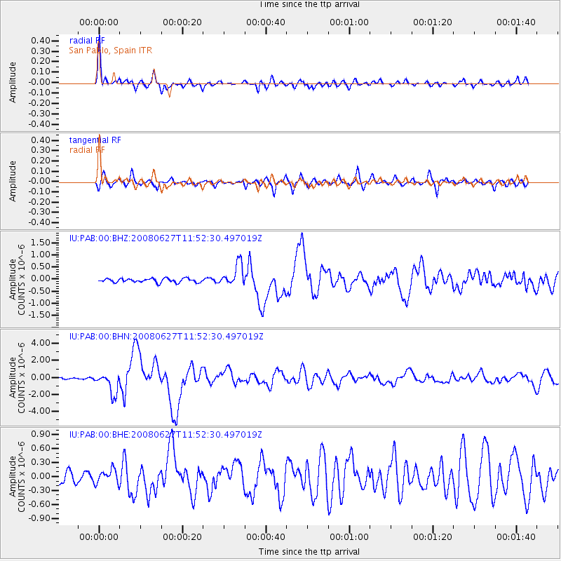
Earthquake location: Andaman Islands, India Region
Earthquake latitude/longitude: 11.0/91.8
Earthquake time(UTC): 2008/06/27 (179) 11:40:13 GMT
Earthquake Depth: 17 km
Earthquake Magnitude: 6.4 MB, 6.7 MS, 6.6 MW, 6.6 MW
Earthquake Catalog/Contributor: WHDF/NEIC
Network: IU Global Seismograph Network (GSN - IRIS/USGS)
Station: PAB San Pablo, Spain
Lat/Lon: 39.55 N/4.35 W
Elevation: 925 m
Distance: 87.8 deg
Az: 309.709 deg
Baz: 77.658 deg
Ray Param: 0.043059886
Estimated Moho Depth: 30.75 km
Estimated Crust Vp/Vs: 1.76
Assumed Crust Vp: 6.276 km/s
Estimated Crust Vs: 3.566 km/s
Estimated Crust Poisson's Ratio: 0.26
Radial Match: 93.18003 %
Radial Bump: 400
Transverse Match: 83.5632 %
Transverse Bump: 400
SOD ConfigId: 2504
Insert Time: 2010-03-04 14:34:38.775 +0000
GWidth: 2.5
Max Bumps: 400
Tol: 0.001

Signal To Noise

ChannelStoNSTALTA
IU:PAB:00:BHN:20080627T11:52:30.497019Z12.6327581.262852E-69.9966456E-8
IU:PAB:00:BHE:20080627T11:52:30.497019Z1.62922911.5087909E-79.260766E-8
IU:PAB:00:BHZ:20080627T11:52:30.497019Z5.9368744.775431E-78.043679E-8
Arrivals
Ps3.8 SECOND
PpPs13 SECOND
PsPs/PpSs17 SECOND