You are here: Home > Network List > AV - Alaska Volcano Observatory Stations List
> Station MAPS Pakushin Southeast, Makushin Volcano, Alaska > Earthquake Result Viewer
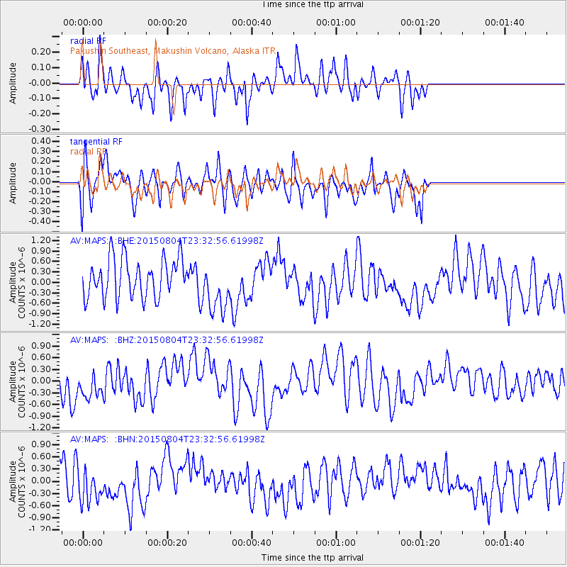
MAPS Pakushin Southeast, Makushin Volcano, Alaska - Earthquake Result Viewer
*The percent match for this event was below the threshold and hence no stack was calculated.
| Earthquake location: |
Kermadec Islands Region |
| Earthquake latitude/longitude: |
-27.4/-176.1 |
| Earthquake time(UTC): |
2015/08/04 (216) 23:21:14 GMT |
| Earthquake Depth: |
31 km |
| Earthquake Magnitude: |
5.3 MW |
| Earthquake Catalog/Contributor: |
ISC/ISC |
|
| Network: |
AV Alaska Volcano Observatory |
| Station: |
MAPS Pakushin Southeast, Makushin Volcano, Alaska |
| Lat/Lon: |
53.81 N/166.94 W |
| Elevation: |
333 m |
|
| Distance: |
81.2 deg |
| Az: |
5.481 deg |
| Baz: |
188.234 deg |
| Ray Param: |
$rayparam |
*The percent match for this event was below the threshold and hence was not used in the summary stack. |
|
| Radial Match: |
64.91823 % |
| Radial Bump: |
400 |
| Transverse Match: |
59.565735 % |
| Transverse Bump: |
400 |
| SOD ConfigId: |
7422571 |
| Insert Time: |
2019-04-20 03:50:30.080 +0000 |
| GWidth: |
2.5 |
| Max Bumps: |
400 |
| Tol: |
0.001 |
|
Signal To Noise
| Channel | StoN | STA | LTA |
| AV:MAPS: :BHZ:20150804T23:32:56.61998Z | 0.77452093 | 3.8315068E-7 | 4.946938E-7 |
| AV:MAPS: :BHN:20150804T23:32:56.61998Z | 1.3215533 | 4.2835424E-7 | 3.2412933E-7 |
| AV:MAPS: :BHE:20150804T23:32:56.61998Z | 1.3755624 | 7.5832816E-7 | 5.512859E-7 |
| Arrivals |
| Ps | |
| PpPs | |
| PsPs/PpSs | |


