You are here: Home > Network List > AV - Alaska Volcano Observatory Stations List
> Station SPCR Ckakachatna River, Mount Spurr, Alaska > Earthquake Result Viewer
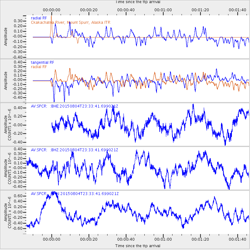
SPCR Ckakachatna River, Mount Spurr, Alaska - Earthquake Result Viewer
*The percent match for this event was below the threshold and hence no stack was calculated.
| Earthquake location: |
Kermadec Islands Region |
| Earthquake latitude/longitude: |
-27.4/-176.1 |
| Earthquake time(UTC): |
2015/08/04 (216) 23:21:14 GMT |
| Earthquake Depth: |
31 km |
| Earthquake Magnitude: |
5.3 MW |
| Earthquake Catalog/Contributor: |
ISC/ISC |
|
| Network: |
AV Alaska Volcano Observatory |
| Station: |
SPCR Ckakachatna River, Mount Spurr, Alaska |
| Lat/Lon: |
61.20 N/152.21 W |
| Elevation: |
984 m |
|
| Distance: |
90.4 deg |
| Az: |
11.31 deg |
| Baz: |
201.109 deg |
| Ray Param: |
$rayparam |
*The percent match for this event was below the threshold and hence was not used in the summary stack. |
|
| Radial Match: |
29.700268 % |
| Radial Bump: |
400 |
| Transverse Match: |
57.13168 % |
| Transverse Bump: |
400 |
| SOD ConfigId: |
7422571 |
| Insert Time: |
2019-04-20 03:50:33.317 +0000 |
| GWidth: |
2.5 |
| Max Bumps: |
400 |
| Tol: |
0.001 |
|
Signal To Noise
| Channel | StoN | STA | LTA |
| AV:SPCR: :BHZ:20150804T23:33:41.699021Z | 0.80119437 | 1.319172E-7 | 1.6465069E-7 |
| AV:SPCR: :BHN:20150804T23:33:41.699021Z | 3.1130419 | 7.5267536E-7 | 2.417813E-7 |
| AV:SPCR: :BHE:20150804T23:33:41.699021Z | 1.8782706 | 2.5811863E-7 | 1.3742356E-7 |
| Arrivals |
| Ps | |
| PpPs | |
| PsPs/PpSs | |


