PAB San Pablo, Spain - Earthquake Result Viewer
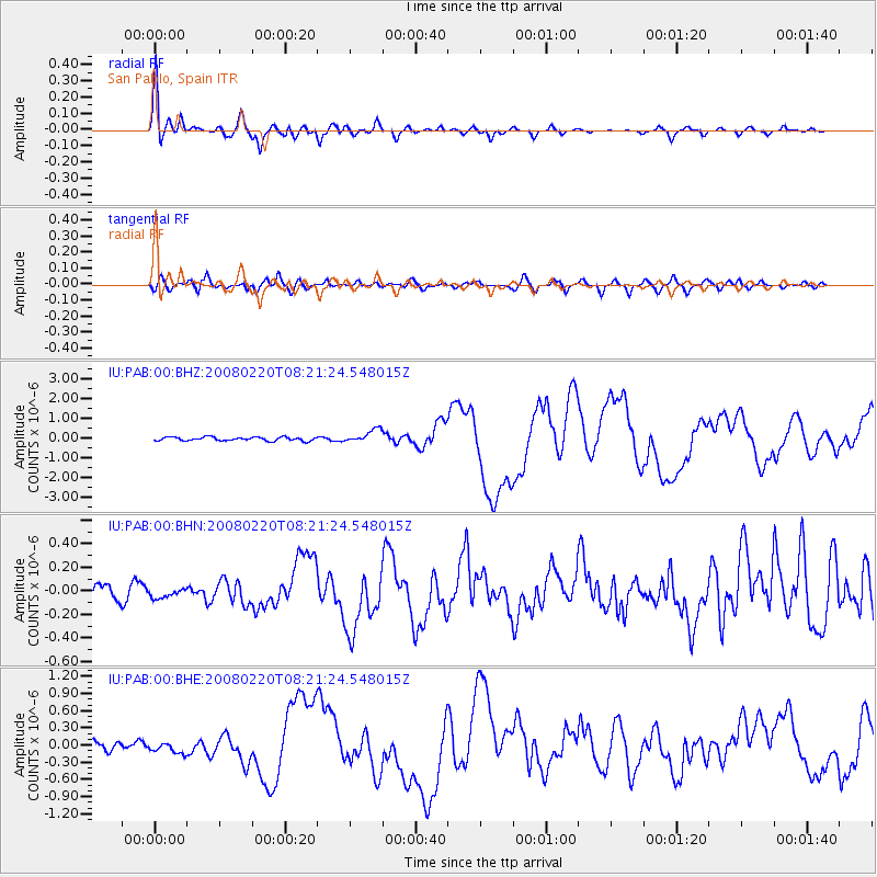
Earthquake location: Off W Coast Of Northern Sumatra
Earthquake latitude/longitude: 2.8/96.0
Earthquake time(UTC): 2008/02/20 (051) 08:08:30 GMT
Earthquake Depth: 26 km
Earthquake Magnitude: 6.5 MB, 7.5 MS, 7.4 MW, 7.4 MW
Earthquake Catalog/Contributor: WHDF/NEIC
Network: IU Global Seismograph Network (GSN - IRIS/USGS)
Station: PAB San Pablo, Spain
Lat/Lon: 39.55 N/4.35 W
Elevation: 925 m
Distance: 96.2 deg
Az: 310.077 deg
Baz: 81.294 deg
Ray Param: 0.04057272
Estimated Moho Depth: 30.0 km
Estimated Crust Vp/Vs: 1.84
Assumed Crust Vp: 6.276 km/s
Estimated Crust Vs: 3.411 km/s
Estimated Crust Poisson's Ratio: 0.29
Radial Match: 95.17124 %
Radial Bump: 400
Transverse Match: 80.167496 %
Transverse Bump: 400
SOD ConfigId: 2564
Insert Time: 2010-03-04 14:35:00.918 +0000
GWidth: 2.5
Max Bumps: 400
Tol: 0.001

Signal To Noise

ChannelStoNSTALTA
IU:PAB:00:BHN:20080220T08:21:24.548015Z0.57249383.6413628E-86.360528E-8
IU:PAB:00:BHE:20080220T08:21:24.548015Z1.19808329.5679475E-87.986046E-8
IU:PAB:00:BHZ:20080220T08:21:24.548015Z3.4645063.3052908E-79.5404395E-8
Arrivals
Ps4.1 SECOND
PpPs13 SECOND
PsPs/PpSs17 SECOND