You are here: Home > Network List > AV - Alaska Volcano Observatory Stations List
> Station SPCR Ckakachatna River, Mount Spurr, Alaska > Earthquake Result Viewer
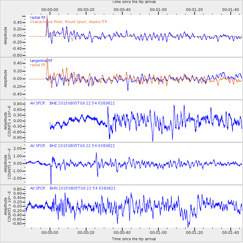
SPCR Ckakachatna River, Mount Spurr, Alaska - Earthquake Result Viewer
*The percent match for this event was below the threshold and hence no stack was calculated.
| Earthquake location: |
Chiapas, Mexico |
| Earthquake latitude/longitude: |
16.2/-93.6 |
| Earthquake time(UTC): |
2015/08/05 (217) 09:13:24 GMT |
| Earthquake Depth: |
110 km |
| Earthquake Magnitude: |
5.7 MWB |
| Earthquake Catalog/Contributor: |
NEIC PDE/NEIC COMCAT |
|
| Network: |
AV Alaska Volcano Observatory |
| Station: |
SPCR Ckakachatna River, Mount Spurr, Alaska |
| Lat/Lon: |
61.20 N/152.21 W |
| Elevation: |
984 m |
|
| Distance: |
61.0 deg |
| Az: |
331.807 deg |
| Baz: |
110.353 deg |
| Ray Param: |
$rayparam |
*The percent match for this event was below the threshold and hence was not used in the summary stack. |
|
| Radial Match: |
76.338936 % |
| Radial Bump: |
400 |
| Transverse Match: |
58.68155 % |
| Transverse Bump: |
400 |
| SOD ConfigId: |
7422571 |
| Insert Time: |
2019-04-20 04:02:29.693 +0000 |
| GWidth: |
2.5 |
| Max Bumps: |
400 |
| Tol: |
0.001 |
|
Signal To Noise
| Channel | StoN | STA | LTA |
| AV:SPCR: :BHZ:20150805T09:22:54.638982Z | 3.3910131 | 7.2200896E-7 | 2.1291837E-7 |
| AV:SPCR: :BHN:20150805T09:22:54.638982Z | 1.5666407 | 2.2451118E-7 | 1.4330739E-7 |
| AV:SPCR: :BHE:20150805T09:22:54.638982Z | 2.458722 | 4.3558848E-7 | 1.771605E-7 |
| Arrivals |
| Ps | |
| PpPs | |
| PsPs/PpSs | |


