You are here: Home > Network List > TA - USArray Transportable Network (new EarthScope stations) Stations List
> Station J01E Myrtle Point, OR, USA > Earthquake Result Viewer
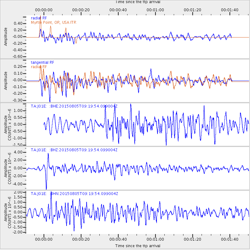
J01E Myrtle Point, OR, USA - Earthquake Result Viewer
*The percent match for this event was below the threshold and hence no stack was calculated.
| Earthquake location: |
Chiapas, Mexico |
| Earthquake latitude/longitude: |
16.2/-93.6 |
| Earthquake time(UTC): |
2015/08/05 (217) 09:13:24 GMT |
| Earthquake Depth: |
110 km |
| Earthquake Magnitude: |
5.7 MWB |
| Earthquake Catalog/Contributor: |
NEIC PDE/NEIC COMCAT |
|
| Network: |
TA USArray Transportable Network (new EarthScope stations) |
| Station: |
J01E Myrtle Point, OR, USA |
| Lat/Lon: |
43.16 N/123.93 W |
| Elevation: |
128 m |
|
| Distance: |
37.3 deg |
| Az: |
322.441 deg |
| Baz: |
126.817 deg |
| Ray Param: |
$rayparam |
*The percent match for this event was below the threshold and hence was not used in the summary stack. |
|
| Radial Match: |
59.893795 % |
| Radial Bump: |
400 |
| Transverse Match: |
68.21518 % |
| Transverse Bump: |
400 |
| SOD ConfigId: |
7422571 |
| Insert Time: |
2019-04-20 04:06:08.871 +0000 |
| GWidth: |
2.5 |
| Max Bumps: |
400 |
| Tol: |
0.001 |
|
Signal To Noise
| Channel | StoN | STA | LTA |
| TA:J01E: :BHZ:20150805T09:19:54.099004Z | 8.745855 | 1.8247296E-6 | 2.0863935E-7 |
| TA:J01E: :BHN:20150805T09:19:54.099004Z | 2.2441742 | 7.5146045E-7 | 3.3484943E-7 |
| TA:J01E: :BHE:20150805T09:19:54.099004Z | 1.4319631 | 4.9140806E-7 | 3.4317094E-7 |
| Arrivals |
| Ps | |
| PpPs | |
| PsPs/PpSs | |


