PAB San Pablo, Spain - Earthquake Result Viewer
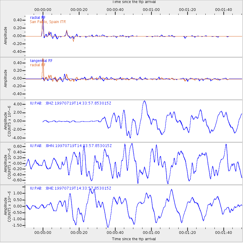
Earthquake location: Near Coast Of Guerrero, Mexico
Earthquake latitude/longitude: 16.3/-98.2
Earthquake time(UTC): 1997/07/19 (200) 14:22:08 GMT
Earthquake Depth: 33 km
Earthquake Magnitude: 5.7 MB, 6.3 MS, 6.8 UNKNOWN, 6.0 ME
Earthquake Catalog/Contributor: WHDF/NEIC
Network: IU Global Seismograph Network (GSN - IRIS/USGS)
Station: PAB San Pablo, Spain
Lat/Lon: 39.55 N/4.35 W
Elevation: 925 m
Distance: 82.7 deg
Az: 51.056 deg
Baz: 285.027 deg
Ray Param: 0.046665322
Estimated Moho Depth: 29.0 km
Estimated Crust Vp/Vs: 1.91
Assumed Crust Vp: 6.276 km/s
Estimated Crust Vs: 3.29 km/s
Estimated Crust Poisson's Ratio: 0.31
Radial Match: 97.93619 %
Radial Bump: 226
Transverse Match: 87.63658 %
Transverse Bump: 400
SOD ConfigId: 6273
Insert Time: 2010-03-04 14:38:24.630 +0000
GWidth: 2.5
Max Bumps: 400
Tol: 0.001

Signal To Noise

ChannelStoNSTALTA
IU:PAB: :BHN:19970719T14:33:57.853015Z1.06175471.17015006E-71.1020907E-7
IU:PAB: :BHE:19970719T14:33:57.853015Z2.03964831.614597E-77.916056E-8
IU:PAB: :BHZ:19970719T14:33:57.853015Z4.8958564.7027643E-79.605602E-8
Arrivals
Ps4.3 SECOND
PpPs13 SECOND
PsPs/PpSs17 SECOND