You are here: Home > Network List > US - United States National Seismic Network Stations List
> Station DGMT Dagmar, Montana, USA > Earthquake Result Viewer
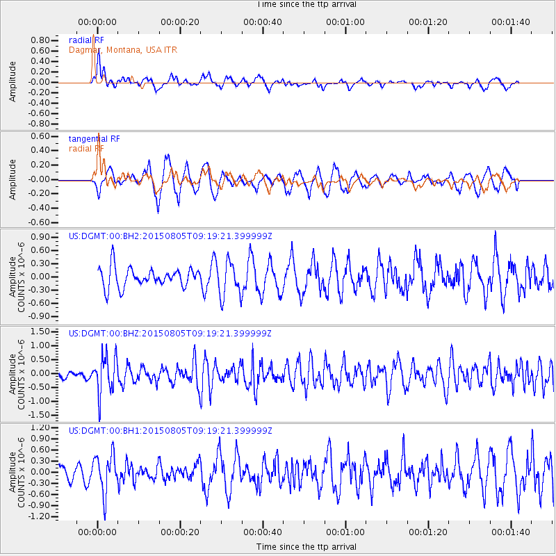
DGMT Dagmar, Montana, USA - Earthquake Result Viewer
*The percent match for this event was below the threshold and hence no stack was calculated.
| Earthquake location: |
Chiapas, Mexico |
| Earthquake latitude/longitude: |
16.2/-93.6 |
| Earthquake time(UTC): |
2015/08/05 (217) 09:13:24 GMT |
| Earthquake Depth: |
110 km |
| Earthquake Magnitude: |
5.7 MWB |
| Earthquake Catalog/Contributor: |
NEIC PDE/NEIC COMCAT |
|
| Network: |
US United States National Seismic Network |
| Station: |
DGMT Dagmar, Montana, USA |
| Lat/Lon: |
48.47 N/104.20 W |
| Elevation: |
0.0 m |
|
| Distance: |
33.4 deg |
| Az: |
347.171 deg |
| Baz: |
161.3 deg |
| Ray Param: |
$rayparam |
*The percent match for this event was below the threshold and hence was not used in the summary stack. |
|
| Radial Match: |
50.893463 % |
| Radial Bump: |
374 |
| Transverse Match: |
65.47874 % |
| Transverse Bump: |
364 |
| SOD ConfigId: |
7422571 |
| Insert Time: |
2019-04-20 04:07:15.036 +0000 |
| GWidth: |
2.5 |
| Max Bumps: |
400 |
| Tol: |
0.001 |
|
Signal To Noise
| Channel | StoN | STA | LTA |
| US:DGMT:00:BHZ:20150805T09:19:21.399999Z | 7.517083 | 7.022127E-7 | 9.341558E-8 |
| US:DGMT:00:BH1:20150805T09:19:21.399999Z | 2.439897 | 5.2463076E-7 | 2.1502167E-7 |
| US:DGMT:00:BH2:20150805T09:19:21.399999Z | 1.7786366 | 3.9701018E-7 | 2.232104E-7 |
| Arrivals |
| Ps | |
| PpPs | |
| PsPs/PpSs | |


