You are here: Home > Network List > UW - Pacific Northwest Regional Seismic Network Stations List
> Station LEBA Lebam, WA, USA > Earthquake Result Viewer
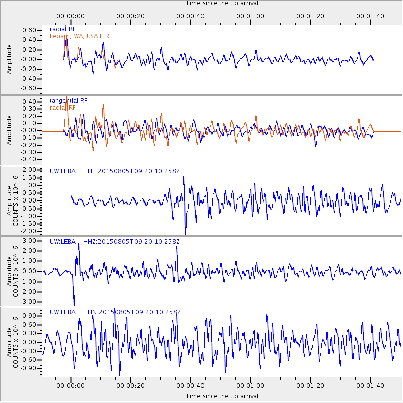
LEBA Lebam, WA, USA - Earthquake Result Viewer
*The percent match for this event was below the threshold and hence no stack was calculated.
| Earthquake location: |
Chiapas, Mexico |
| Earthquake latitude/longitude: |
16.2/-93.6 |
| Earthquake time(UTC): |
2015/08/05 (217) 09:13:24 GMT |
| Earthquake Depth: |
110 km |
| Earthquake Magnitude: |
5.7 MWB |
| Earthquake Catalog/Contributor: |
NEIC PDE/NEIC COMCAT |
|
| Network: |
UW Pacific Northwest Regional Seismic Network |
| Station: |
LEBA Lebam, WA, USA |
| Lat/Lon: |
46.55 N/123.56 W |
| Elevation: |
73 m |
|
| Distance: |
39.2 deg |
| Az: |
326.972 deg |
| Baz: |
130.635 deg |
| Ray Param: |
$rayparam |
*The percent match for this event was below the threshold and hence was not used in the summary stack. |
|
| Radial Match: |
75.18758 % |
| Radial Bump: |
400 |
| Transverse Match: |
69.56385 % |
| Transverse Bump: |
400 |
| SOD ConfigId: |
7422571 |
| Insert Time: |
2019-04-20 04:07:31.382 +0000 |
| GWidth: |
2.5 |
| Max Bumps: |
400 |
| Tol: |
0.001 |
|
Signal To Noise
| Channel | StoN | STA | LTA |
| UW:LEBA: :HHZ:20150805T09:20:10.258Z | 6.0529103 | 1.2115432E-6 | 2.001588E-7 |
| UW:LEBA: :HHN:20150805T09:20:10.258Z | 2.352347 | 4.618625E-7 | 1.9634115E-7 |
| UW:LEBA: :HHE:20150805T09:20:10.258Z | 2.8452682 | 4.5067907E-7 | 1.5839599E-7 |
| Arrivals |
| Ps | |
| PpPs | |
| PsPs/PpSs | |


