You are here: Home > Network List > UW - Pacific Northwest Regional Seismic Network Stations List
> Station MRBL Marblemount, WA, USA > Earthquake Result Viewer
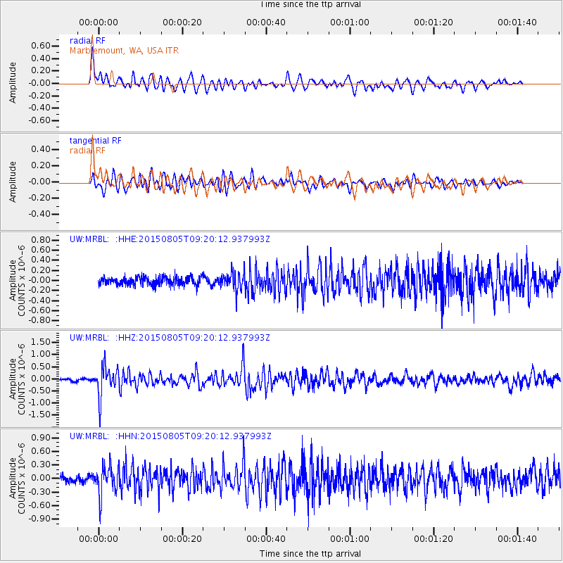
MRBL Marblemount, WA, USA - Earthquake Result Viewer
*The percent match for this event was below the threshold and hence no stack was calculated.
| Earthquake location: |
Chiapas, Mexico |
| Earthquake latitude/longitude: |
16.2/-93.6 |
| Earthquake time(UTC): |
2015/08/05 (217) 09:13:24 GMT |
| Earthquake Depth: |
110 km |
| Earthquake Magnitude: |
5.7 MWB |
| Earthquake Catalog/Contributor: |
NEIC PDE/NEIC COMCAT |
|
| Network: |
UW Pacific Northwest Regional Seismic Network |
| Station: |
MRBL Marblemount, WA, USA |
| Lat/Lon: |
48.52 N/121.48 W |
| Elevation: |
75 m |
|
| Distance: |
39.5 deg |
| Az: |
330.764 deg |
| Baz: |
135.097 deg |
| Ray Param: |
$rayparam |
*The percent match for this event was below the threshold and hence was not used in the summary stack. |
|
| Radial Match: |
80.09282 % |
| Radial Bump: |
400 |
| Transverse Match: |
67.23114 % |
| Transverse Bump: |
400 |
| SOD ConfigId: |
7422571 |
| Insert Time: |
2019-04-20 04:07:32.805 +0000 |
| GWidth: |
2.5 |
| Max Bumps: |
400 |
| Tol: |
0.001 |
|
Signal To Noise
| Channel | StoN | STA | LTA |
| UW:MRBL: :HHZ:20150805T09:20:12.937993Z | 13.525195 | 6.173679E-7 | 4.5645766E-8 |
| UW:MRBL: :HHN:20150805T09:20:12.937993Z | 3.9052956 | 3.24752E-7 | 8.315683E-8 |
| UW:MRBL: :HHE:20150805T09:20:12.937993Z | 2.5427964 | 2.0977788E-7 | 8.249889E-8 |
| Arrivals |
| Ps | |
| PpPs | |
| PsPs/PpSs | |


