You are here: Home > Network List > IU - Global Seismograph Network (GSN - IRIS/USGS) Stations List
> Station CASY Casey, Antarctica > Earthquake Result Viewer
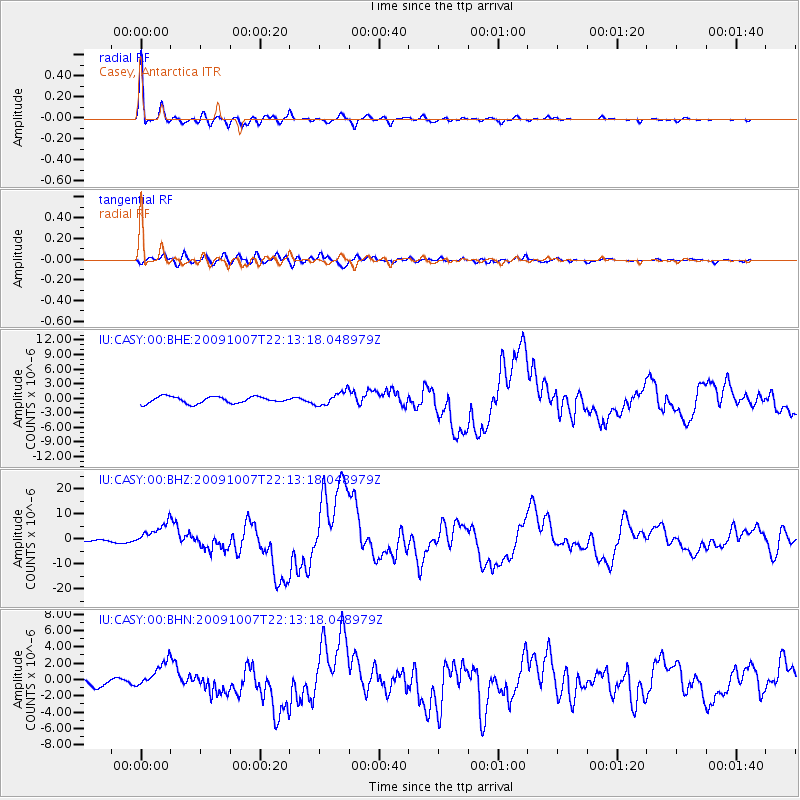
CASY Casey, Antarctica - Earthquake Result Viewer

| Earthquake location: |
Vanuatu Islands |
| Earthquake latitude/longitude: |
-13.0/166.5 |
| Earthquake time(UTC): |
2009/10/07 (280) 22:03:14 GMT |
| Earthquake Depth: |
45 km |
| Earthquake Magnitude: |
6.4 MB, 7.3 MS, 7.6 MW, 7.7 MW |
| Earthquake Catalog/Contributor: |
WHDF/NEIC |
|
| Network: |
IU Global Seismograph Network (GSN - IRIS/USGS) |
| Station: |
CASY Casey, Antarctica |
| Lat/Lon: |
66.28 S/110.54 E |
| Elevation: |
10 m |
|
| Distance: |
64.8 deg |
| Az: |
201.742 deg |
| Baz: |
63.186 deg |
| Ray Param: |
0.058574174 |
| Estimated Moho Depth: |
24.75 km |
| Estimated Crust Vp/Vs: |
1.93 |
| Assumed Crust Vp: |
6.356 km/s |
| Estimated Crust Vs: |
3.293 km/s |
| Estimated Crust Poisson's Ratio: |
0.32 |
|
| Radial Match: |
92.94267 % |
| Radial Bump: |
392 |
| Transverse Match: |
76.7554 % |
| Transverse Bump: |
400 |
| SOD ConfigId: |
1 |
| Insert Time: |
2010-02-19 00:34:58.446 +0000 |
| GWidth: |
2.5 |
| Max Bumps: |
400 |
| Tol: |
0.001 |
|
Signal To Noise
| Channel | StoN | STA | LTA |
| IU:CASY:00:BHZ:20091007T22:13:18.048979Z | 7.386445 | 4.8455086E-6 | 6.5600005E-7 |
| IU:CASY:00:BHN:20091007T22:13:18.048979Z | 3.7890458 | 1.6615489E-6 | 4.3851384E-7 |
| IU:CASY:00:BHE:20091007T22:13:18.048979Z | 2.0934415 | 1.4158493E-6 | 6.763262E-7 |
| Arrivals |
| Ps | 3.8 SECOND |
| PpPs | 11 SECOND |
| PsPs/PpSs | 15 SECOND |


