You are here: Home > Network List > CI - Caltech Regional Seismic Network Stations List
> Station GLA Glamis, California, USA > Earthquake Result Viewer
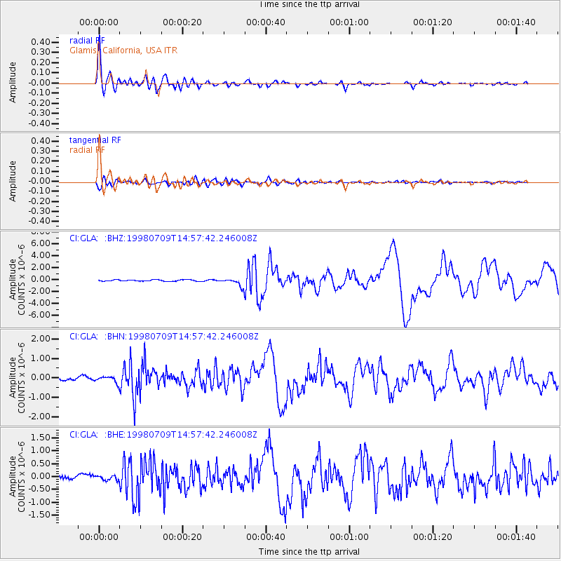
GLA Glamis, California, USA - Earthquake Result Viewer

| Earthquake location: |
Kermadec Islands, New Zealand |
| Earthquake latitude/longitude: |
-30.5/-179.0 |
| Earthquake time(UTC): |
1998/07/09 (190) 14:45:39 GMT |
| Earthquake Depth: |
130 km |
| Earthquake Magnitude: |
6.2 MB, 6.2 MS, 6.9 UNKNOWN, 6.4 ME |
| Earthquake Catalog/Contributor: |
WHDF/NEIC |
|
| Network: |
CI Caltech Regional Seismic Network |
| Station: |
GLA Glamis, California, USA |
| Lat/Lon: |
33.05 N/114.83 W |
| Elevation: |
627 m |
|
| Distance: |
87.6 deg |
| Az: |
49.164 deg |
| Baz: |
231.046 deg |
| Ray Param: |
0.042922758 |
| Estimated Moho Depth: |
27.25 km |
| Estimated Crust Vp/Vs: |
1.60 |
| Assumed Crust Vp: |
6.155 km/s |
| Estimated Crust Vs: |
3.841 km/s |
| Estimated Crust Poisson's Ratio: |
0.18 |
|
| Radial Match: |
95.9492 % |
| Radial Bump: |
400 |
| Transverse Match: |
85.632645 % |
| Transverse Bump: |
400 |
| SOD ConfigId: |
4770 |
| Insert Time: |
2010-02-25 21:47:57.661 +0000 |
| GWidth: |
2.5 |
| Max Bumps: |
400 |
| Tol: |
0.001 |
|
Signal To Noise
| Channel | StoN | STA | LTA |
| CI:GLA: :BHN:19980709T14:57:42.246008Z | 2.5220284 | 1.6123647E-7 | 6.393127E-8 |
| CI:GLA: :BHE:19980709T14:57:42.246008Z | 1.0750946 | 8.298474E-8 | 7.718832E-8 |
| CI:GLA: :BHZ:19980709T14:57:42.246008Z | 6.0577154 | 6.868736E-7 | 1.13388225E-7 |
| Arrivals |
| Ps | 2.7 SECOND |
| PpPs | 11 SECOND |
| PsPs/PpSs | 14 SECOND |


