You are here: Home > Network List > TA - USArray Transportable Network (new EarthScope stations) Stations List
> Station MSTX Muleshoe, TX, USA > Earthquake Result Viewer
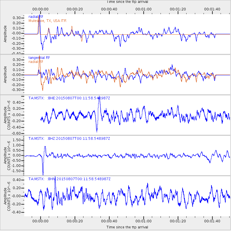
MSTX Muleshoe, TX, USA - Earthquake Result Viewer
*The percent match for this event was below the threshold and hence no stack was calculated.
| Earthquake location: |
South Of Fiji Islands |
| Earthquake latitude/longitude: |
-26.5/-178.3 |
| Earthquake time(UTC): |
2015/08/06 (218) 23:59:45 GMT |
| Earthquake Depth: |
264 km |
| Earthquake Magnitude: |
5.9 MB |
| Earthquake Catalog/Contributor: |
NEIC PDE/NEIC ALERT |
|
| Network: |
TA USArray Transportable Network (new EarthScope stations) |
| Station: |
MSTX Muleshoe, TX, USA |
| Lat/Lon: |
33.97 N/102.77 W |
| Elevation: |
1167 m |
|
| Distance: |
93.5 deg |
| Az: |
53.723 deg |
| Baz: |
240.395 deg |
| Ray Param: |
$rayparam |
*The percent match for this event was below the threshold and hence was not used in the summary stack. |
|
| Radial Match: |
68.572044 % |
| Radial Bump: |
400 |
| Transverse Match: |
53.25121 % |
| Transverse Bump: |
400 |
| SOD ConfigId: |
7422571 |
| Insert Time: |
2019-04-20 04:39:53.049 +0000 |
| GWidth: |
2.5 |
| Max Bumps: |
400 |
| Tol: |
0.001 |
|
Signal To Noise
| Channel | StoN | STA | LTA |
| TA:MSTX: :BHZ:20150807T00:11:58.548987Z | 8.227671 | 6.154124E-7 | 7.479788E-8 |
| TA:MSTX: :BHN:20150807T00:11:58.548987Z | 1.1048504 | 1.436838E-7 | 1.300482E-7 |
| TA:MSTX: :BHE:20150807T00:11:58.548987Z | 2.8632903 | 3.0095518E-7 | 1.05108164E-7 |
| Arrivals |
| Ps | |
| PpPs | |
| PsPs/PpSs | |


