You are here: Home > Network List > US - United States National Seismic Network Stations List
> Station HAWA Hanford, Washington, USA > Earthquake Result Viewer
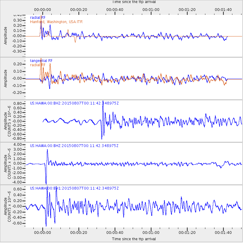
HAWA Hanford, Washington, USA - Earthquake Result Viewer
*The percent match for this event was below the threshold and hence no stack was calculated.
| Earthquake location: |
South Of Fiji Islands |
| Earthquake latitude/longitude: |
-26.5/-178.3 |
| Earthquake time(UTC): |
2015/08/06 (218) 23:59:45 GMT |
| Earthquake Depth: |
264 km |
| Earthquake Magnitude: |
5.9 MB |
| Earthquake Catalog/Contributor: |
NEIC PDE/NEIC ALERT |
|
| Network: |
US United States National Seismic Network |
| Station: |
HAWA Hanford, Washington, USA |
| Lat/Lon: |
46.39 N/119.53 W |
| Elevation: |
364 m |
|
| Distance: |
89.9 deg |
| Az: |
36.286 deg |
| Baz: |
230.032 deg |
| Ray Param: |
$rayparam |
*The percent match for this event was below the threshold and hence was not used in the summary stack. |
|
| Radial Match: |
79.8529 % |
| Radial Bump: |
400 |
| Transverse Match: |
69.83856 % |
| Transverse Bump: |
400 |
| SOD ConfigId: |
7422571 |
| Insert Time: |
2019-04-20 04:40:52.208 +0000 |
| GWidth: |
2.5 |
| Max Bumps: |
400 |
| Tol: |
0.001 |
|
Signal To Noise
| Channel | StoN | STA | LTA |
| US:HAWA:00:BHZ:20150807T00:11:42.348975Z | 18.126944 | 1.4232803E-6 | 7.8517395E-8 |
| US:HAWA:00:BH1:20150807T00:11:42.348975Z | 5.349509 | 2.9800196E-7 | 5.570642E-8 |
| US:HAWA:00:BH2:20150807T00:11:42.348975Z | 5.5053368 | 3.4822642E-7 | 6.325252E-8 |
| Arrivals |
| Ps | |
| PpPs | |
| PsPs/PpSs | |


