You are here: Home > Network List > UW - Pacific Northwest Regional Seismic Network Stations List
> Station MRBL Marblemount, WA, USA > Earthquake Result Viewer
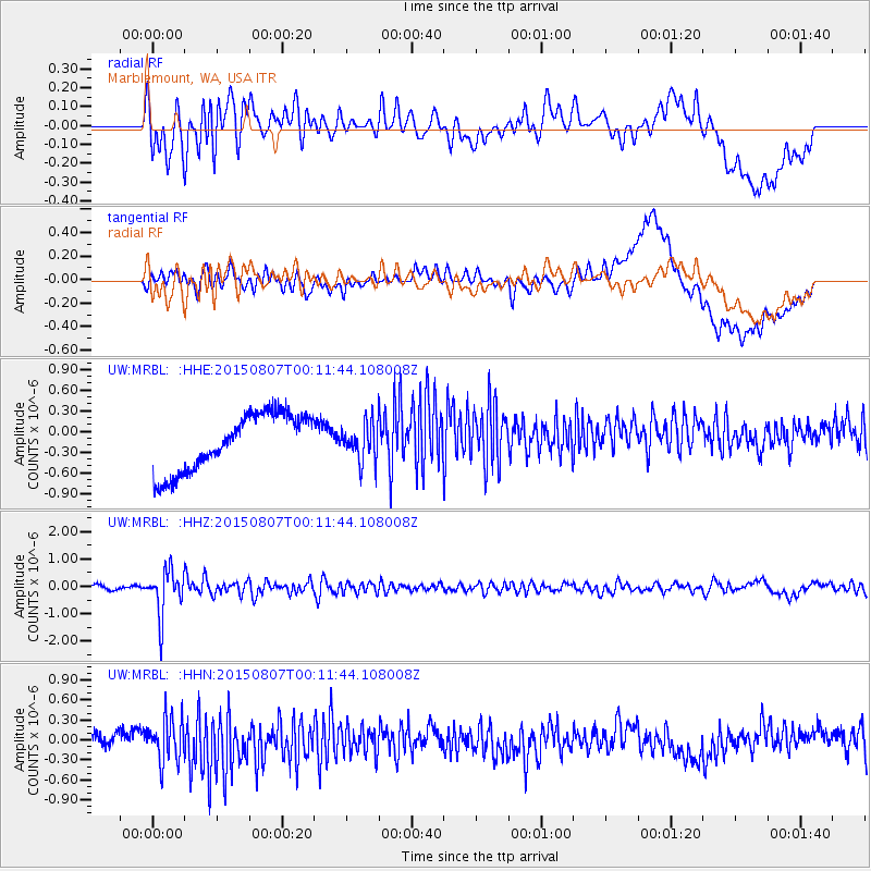
MRBL Marblemount, WA, USA - Earthquake Result Viewer
*The percent match for this event was below the threshold and hence no stack was calculated.
| Earthquake location: |
South Of Fiji Islands |
| Earthquake latitude/longitude: |
-26.5/-178.3 |
| Earthquake time(UTC): |
2015/08/06 (218) 23:59:45 GMT |
| Earthquake Depth: |
264 km |
| Earthquake Magnitude: |
5.9 MB |
| Earthquake Catalog/Contributor: |
NEIC PDE/NEIC ALERT |
|
| Network: |
UW Pacific Northwest Regional Seismic Network |
| Station: |
MRBL Marblemount, WA, USA |
| Lat/Lon: |
48.52 N/121.48 W |
| Elevation: |
75 m |
|
| Distance: |
90.3 deg |
| Az: |
33.81 deg |
| Baz: |
228.602 deg |
| Ray Param: |
$rayparam |
*The percent match for this event was below the threshold and hence was not used in the summary stack. |
|
| Radial Match: |
56.882885 % |
| Radial Bump: |
400 |
| Transverse Match: |
56.761005 % |
| Transverse Bump: |
400 |
| SOD ConfigId: |
7422571 |
| Insert Time: |
2019-04-20 04:41:14.687 +0000 |
| GWidth: |
2.5 |
| Max Bumps: |
400 |
| Tol: |
0.001 |
|
Signal To Noise
| Channel | StoN | STA | LTA |
| UW:MRBL: :HHZ:20150807T00:11:44.108008Z | 12.869315 | 8.305258E-7 | 6.453535E-8 |
| UW:MRBL: :HHN:20150807T00:11:44.108008Z | 1.5082046 | 3.2779576E-7 | 2.1734172E-7 |
| UW:MRBL: :HHE:20150807T00:11:44.108008Z | 0.7843342 | 3.0766265E-7 | 3.9225964E-7 |
| Arrivals |
| Ps | |
| PpPs | |
| PsPs/PpSs | |


