You are here: Home > Network List > KN - Kyrgyz Seismic Telemetry Network Stations List
> Station ULHL - > Earthquake Result Viewer
ULHL - - Earthquake Result Viewer
*The percent match for this event was below the threshold and hence no stack was calculated.
| Earthquake location: |
Lake Tanganyika Region |
| Earthquake latitude/longitude: |
-2.2/28.9 |
| Earthquake time(UTC): |
2015/08/07 (219) 01:25:02 GMT |
| Earthquake Depth: |
10 km |
| Earthquake Magnitude: |
5.6 MB |
| Earthquake Catalog/Contributor: |
NEIC PDE/NEIC COMCAT |
|
| Network: |
KN Kyrgyz Seismic Telemetry Network |
| Station: |
ULHL - |
| Lat/Lon: |
42.25 N/76.24 E |
| Elevation: |
2040 m |
|
| Distance: |
61.5 deg |
| Az: |
38.436 deg |
| Baz: |
236.784 deg |
| Ray Param: |
$rayparam |
*The percent match for this event was below the threshold and hence was not used in the summary stack. |
|
| Radial Match: |
74.618774 % |
| Radial Bump: |
392 |
| Transverse Match: |
66.77979 % |
| Transverse Bump: |
400 |
| SOD ConfigId: |
7422571 |
| Insert Time: |
2019-04-20 04:45:08.605 +0000 |
| GWidth: |
2.5 |
| Max Bumps: |
400 |
| Tol: |
0.001 |
|
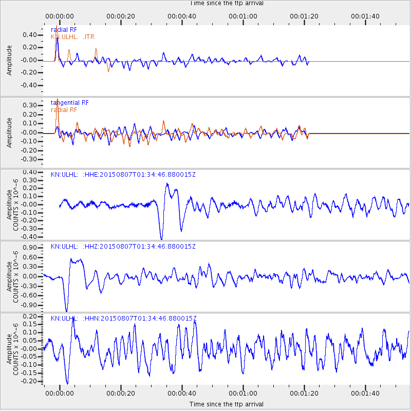
Signal To Noise
| Channel | StoN | STA | LTA |
| KN:ULHL: :HHZ:20150807T01:34:46.880015Z | 8.15697 | 5.088207E-7 | 6.237864E-8 |
| KN:ULHL: :HHN:20150807T01:34:46.880015Z | 4.0932064 | 1.1425154E-7 | 2.791248E-8 |
| KN:ULHL: :HHE:20150807T01:34:46.880015Z | 8.085999 | 2.1059965E-7 | 2.604498E-8 |
| Arrivals |
| Ps | |
| PpPs | |
| PsPs/PpSs | |


