You are here: Home > Network List > TA - USArray Transportable Network (new EarthScope stations) Stations List
> Station H17A Grant Village (NPS), Yellowstone Nt. Park, WY, USA > Earthquake Result Viewer
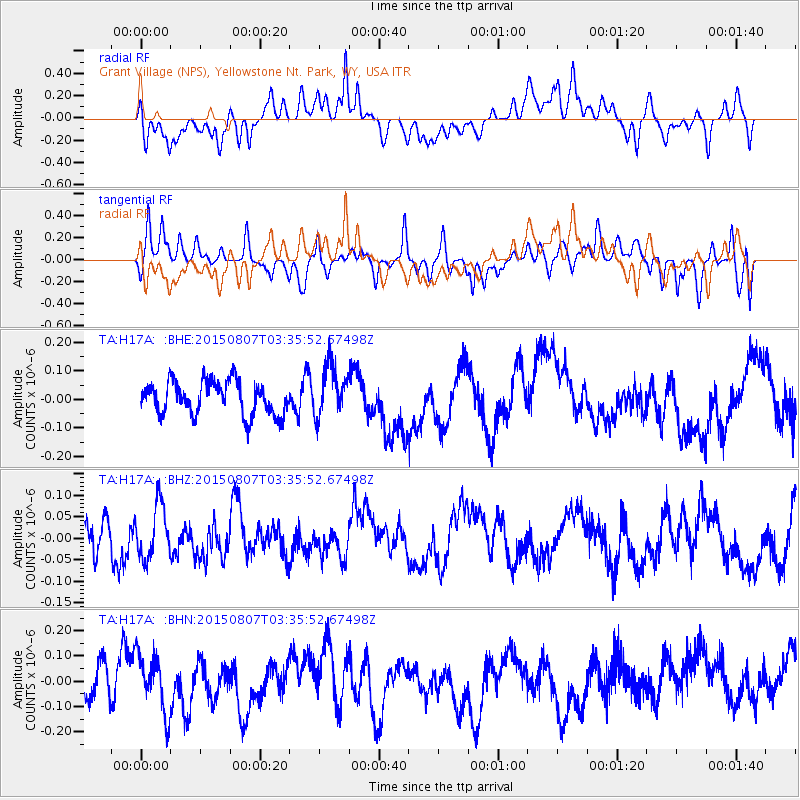
H17A Grant Village (NPS), Yellowstone Nt. Park, WY, USA - Earthquake Result Viewer
*The percent match for this event was below the threshold and hence no stack was calculated.
| Earthquake location: |
Kermadec Islands Region |
| Earthquake latitude/longitude: |
-30.3/179.5 |
| Earthquake time(UTC): |
2015/08/07 (219) 03:22:47 GMT |
| Earthquake Depth: |
0.0 km |
| Earthquake Magnitude: |
3.7 mb |
| Earthquake Catalog/Contributor: |
ISC/ISC |
|
| Network: |
TA USArray Transportable Network (new EarthScope stations) |
| Station: |
H17A Grant Village (NPS), Yellowstone Nt. Park, WY, USA |
| Lat/Lon: |
44.40 N/110.58 W |
| Elevation: |
2400 m |
|
| Distance: |
97.9 deg |
| Az: |
42.82 deg |
| Baz: |
235.093 deg |
| Ray Param: |
$rayparam |
*The percent match for this event was below the threshold and hence was not used in the summary stack. |
|
| Radial Match: |
59.66688 % |
| Radial Bump: |
400 |
| Transverse Match: |
59.234768 % |
| Transverse Bump: |
400 |
| SOD ConfigId: |
7422571 |
| Insert Time: |
2019-04-20 04:54:25.720 +0000 |
| GWidth: |
2.5 |
| Max Bumps: |
400 |
| Tol: |
0.001 |
|
Signal To Noise
| Channel | StoN | STA | LTA |
| TA:H17A: :BHZ:20150807T03:35:52.67498Z | 0.72378284 | 6.240234E-8 | 8.621694E-8 |
| TA:H17A: :BHN:20150807T03:35:52.67498Z | 1.6163453 | 1.11804454E-7 | 6.917115E-8 |
| TA:H17A: :BHE:20150807T03:35:52.67498Z | 1.5486256 | 8.9976396E-8 | 5.8100806E-8 |
| Arrivals |
| Ps | |
| PpPs | |
| PsPs/PpSs | |


