You are here: Home > Network List > TA - USArray Transportable Network (new EarthScope stations) Stations List
> Station J20K Nowitna River, AK, USA > Earthquake Result Viewer
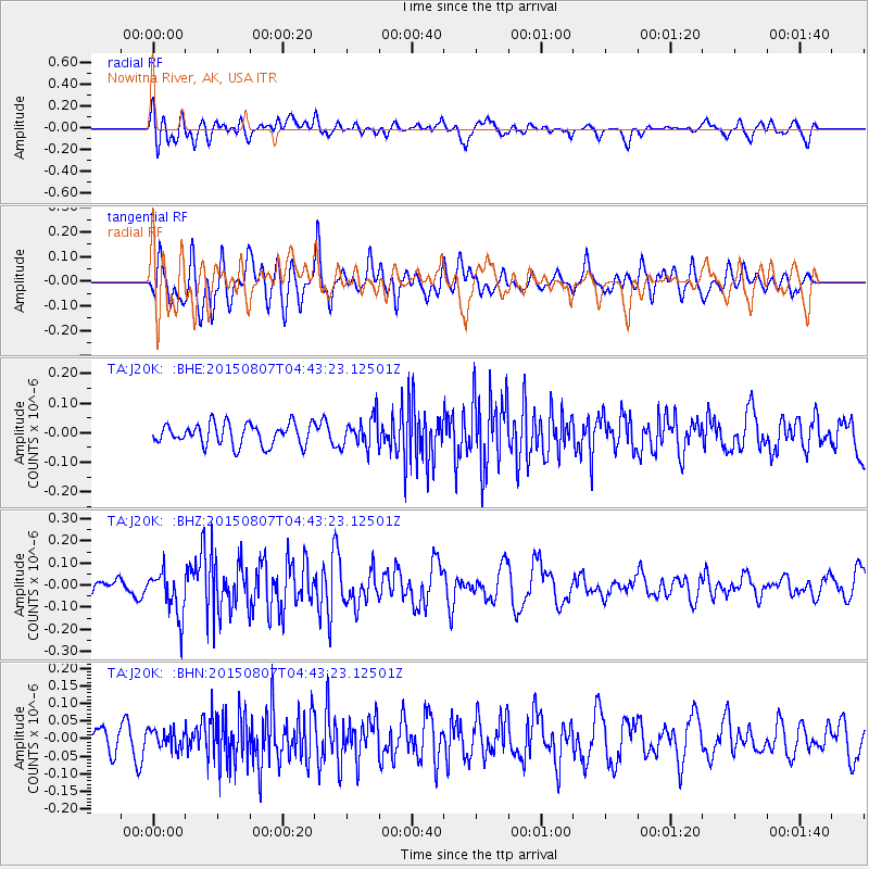
J20K Nowitna River, AK, USA - Earthquake Result Viewer
*The percent match for this event was below the threshold and hence no stack was calculated.
| Earthquake location: |
Gulf Of California |
| Earthquake latitude/longitude: |
24.0/-108.9 |
| Earthquake time(UTC): |
2015/08/07 (219) 04:35:01 GMT |
| Earthquake Depth: |
10 km |
| Earthquake Magnitude: |
5.4 MW |
| Earthquake Catalog/Contributor: |
ISC/ISC |
|
| Network: |
TA USArray Transportable Network (new EarthScope stations) |
| Station: |
J20K Nowitna River, AK, USA |
| Lat/Lon: |
64.18 N/154.15 W |
| Elevation: |
314 m |
|
| Distance: |
49.7 deg |
| Az: |
335.967 deg |
| Baz: |
121.767 deg |
| Ray Param: |
$rayparam |
*The percent match for this event was below the threshold and hence was not used in the summary stack. |
|
| Radial Match: |
60.196053 % |
| Radial Bump: |
400 |
| Transverse Match: |
57.05245 % |
| Transverse Bump: |
400 |
| SOD ConfigId: |
7422571 |
| Insert Time: |
2019-04-20 04:59:04.030 +0000 |
| GWidth: |
2.5 |
| Max Bumps: |
400 |
| Tol: |
0.001 |
|
Signal To Noise
| Channel | StoN | STA | LTA |
| TA:J20K: :BHZ:20150807T04:43:23.12501Z | 2.082532 | 1.04073294E-7 | 4.9974407E-8 |
| TA:J20K: :BHN:20150807T04:43:23.12501Z | 0.5350515 | 2.640167E-8 | 4.9344163E-8 |
| TA:J20K: :BHE:20150807T04:43:23.12501Z | 1.3856688 | 5.0311396E-8 | 3.6308386E-8 |
| Arrivals |
| Ps | |
| PpPs | |
| PsPs/PpSs | |


