
SBA Scott Base, Antarctica - Earthquake Result Viewer
| ||||||||||||||||||
| ||||||||||||||||||
| ||||||||||||||||||
|
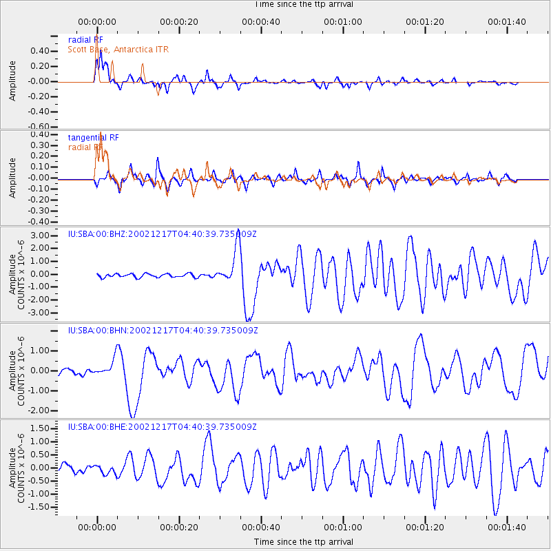
Signal To Noise
| Channel | StoN | STA | LTA |
| IU:SBA:00:BHN:20021217T04:40:39.735009Z | 2.83438 | 4.6258825E-7 | 1.6320615E-7 |
| IU:SBA:00:BHE:20021217T04:40:39.735009Z | 1.1217163 | 1.734375E-7 | 1.5461798E-7 |
| IU:SBA:00:BHZ:20021217T04:40:39.735009Z | 10.710751 | 1.4936783E-6 | 1.3945598E-7 |
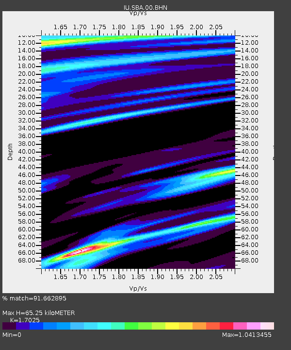
| Arrivals | |
| Ps | 7.9 SECOND |
| PpPs | 27 SECOND |
| PsPs/PpSs | 35 SECOND |

