You are here: Home > Network List > US - United States National Seismic Network Stations List
> Station DGMT Dagmar, Montana, USA > Earthquake Result Viewer
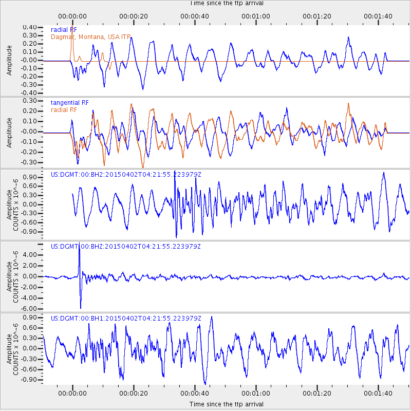
DGMT Dagmar, Montana, USA - Earthquake Result Viewer
*The percent match for this event was below the threshold and hence no stack was calculated.
| Earthquake location: |
Fiji Islands Region |
| Earthquake latitude/longitude: |
-17.8/-178.7 |
| Earthquake time(UTC): |
2015/04/02 (092) 04:10:09 GMT |
| Earthquake Depth: |
536 km |
| Earthquake Magnitude: |
6.0 MWP |
| Earthquake Catalog/Contributor: |
NEIC PDE/NEIC COMCAT |
|
| Network: |
US United States National Seismic Network |
| Station: |
DGMT Dagmar, Montana, USA |
| Lat/Lon: |
48.47 N/104.20 W |
| Elevation: |
0.0 m |
|
| Distance: |
93.3 deg |
| Az: |
39.961 deg |
| Baz: |
246.847 deg |
| Ray Param: |
$rayparam |
*The percent match for this event was below the threshold and hence was not used in the summary stack. |
|
| Radial Match: |
49.170635 % |
| Radial Bump: |
400 |
| Transverse Match: |
60.76759 % |
| Transverse Bump: |
400 |
| SOD ConfigId: |
872571 |
| Insert Time: |
2015-04-16 04:30:43.075 +0000 |
| GWidth: |
2.5 |
| Max Bumps: |
400 |
| Tol: |
0.001 |
|
Signal To Noise
| Channel | StoN | STA | LTA |
| US:DGMT:00:BHZ:20150402T04:21:55.223979Z | 7.1187778 | 1.9499032E-6 | 2.7390982E-7 |
| US:DGMT:00:BH1:20150402T04:21:55.223979Z | 0.6275964 | 2.0165508E-7 | 3.2131334E-7 |
| US:DGMT:00:BH2:20150402T04:21:55.223979Z | 1.1204172 | 3.9825503E-7 | 3.5545244E-7 |
| Arrivals |
| Ps | |
| PpPs | |
| PsPs/PpSs | |


