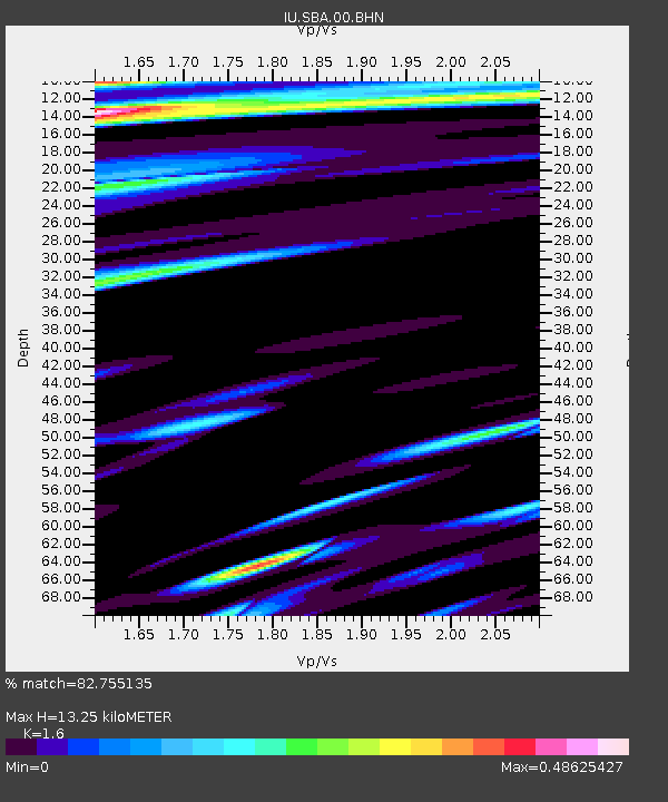
SBA Scott Base, Antarctica - Earthquake Result Viewer
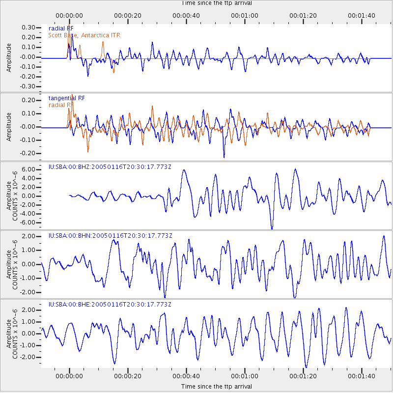
Earthquake location: W. Caroline Islands, Micronesia
Earthquake latitude/longitude: 10.9/140.8
Earthquake time(UTC): 2005/01/16 (016) 20:17:52 GMT
Earthquake Depth: 25 km
Earthquake Magnitude: 6.3 MB, 6.7 MS, 6.6 MW, 6.6 MW
Earthquake Catalog/Contributor: WHDF/NEIC
Network: IU Global Seismograph Network (GSN - IRIS/USGS)
Station: SBA Scott Base, Antarctica
Lat/Lon: 77.85 S/166.76 E
Elevation: 20 m
Distance: 89.8 deg
Az: 174.688 deg
Baz: 334.582 deg
Ray Param: 0.041714165
Estimated Moho Depth: 13.25 km
Estimated Crust Vp/Vs: 1.60
Assumed Crust Vp: 6.183 km/s
Estimated Crust Vs: 3.864 km/s
Estimated Crust Poisson's Ratio: 0.18
Radial Match: 82.755135 %
Radial Bump: 400
Transverse Match: 73.35871 %
Transverse Bump: 400
SOD ConfigId: 5233
Insert Time: 2010-03-04 14:50:07.647 +0000
GWidth: 2.5
Max Bumps: 400
Tol: 0.001

Signal To Noise

ChannelStoNSTALTA
IU:SBA:00:BHN:20050116T20:30:17.773Z0.9189133.7226286E-74.051122E-7
IU:SBA:00:BHE:20050116T20:30:17.773Z1.38216968.674433E-76.275954E-7
IU:SBA:00:BHZ:20050116T20:30:17.773Z2.35103181.3413477E-65.7053575E-7
Arrivals
Ps1.3 SECOND
PpPs5.5 SECOND
PsPs/PpSs6.8 SECOND