You are here: Home > Network List > TA - USArray Transportable Network (new EarthScope stations) Stations List
> Station R11A Troy Canyon, Currant, NV, USA > Earthquake Result Viewer
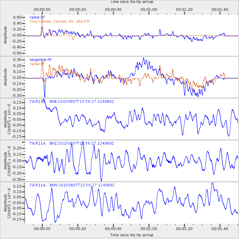
R11A Troy Canyon, Currant, NV, USA - Earthquake Result Viewer
*The percent match for this event was below the threshold and hence no stack was calculated.
| Earthquake location: |
Off Coast Of Ecuador |
| Earthquake latitude/longitude: |
1.2/-85.2 |
| Earthquake time(UTC): |
2015/08/07 (219) 13:48:31 GMT |
| Earthquake Depth: |
10 km |
| Earthquake Magnitude: |
5.6 MW |
| Earthquake Catalog/Contributor: |
ISC/ISC |
|
| Network: |
TA USArray Transportable Network (new EarthScope stations) |
| Station: |
R11A Troy Canyon, Currant, NV, USA |
| Lat/Lon: |
38.35 N/115.59 W |
| Elevation: |
1756 m |
|
| Distance: |
46.3 deg |
| Az: |
326.63 deg |
| Baz: |
135.619 deg |
| Ray Param: |
$rayparam |
*The percent match for this event was below the threshold and hence was not used in the summary stack. |
|
| Radial Match: |
44.139126 % |
| Radial Bump: |
400 |
| Transverse Match: |
40.842182 % |
| Transverse Bump: |
400 |
| SOD ConfigId: |
7422571 |
| Insert Time: |
2019-04-20 05:13:08.226 +0000 |
| GWidth: |
2.5 |
| Max Bumps: |
400 |
| Tol: |
0.001 |
|
Signal To Noise
| Channel | StoN | STA | LTA |
| TA:R11A: :BHZ:20150807T13:56:27.124989Z | 1.0060259 | 4.769692E-8 | 4.7411223E-8 |
| TA:R11A: :BHN:20150807T13:56:27.124989Z | 1.9913303 | 1.7331216E-7 | 8.703336E-8 |
| TA:R11A: :BHE:20150807T13:56:27.124989Z | 1.6661754 | 1.0115627E-7 | 6.0711656E-8 |
| Arrivals |
| Ps | |
| PpPs | |
| PsPs/PpSs | |


