You are here: Home > Network List > US - United States National Seismic Network Stations List
> Station WMOK Wichita Mountains, Oklahoma, USA > Earthquake Result Viewer
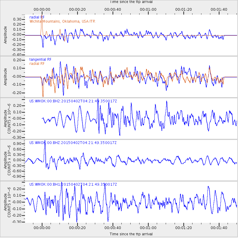
WMOK Wichita Mountains, Oklahoma, USA - Earthquake Result Viewer
*The percent match for this event was below the threshold and hence no stack was calculated.
| Earthquake location: |
Fiji Islands Region |
| Earthquake latitude/longitude: |
-17.8/-178.7 |
| Earthquake time(UTC): |
2015/04/02 (092) 04:10:09 GMT |
| Earthquake Depth: |
536 km |
| Earthquake Magnitude: |
6.0 MWP |
| Earthquake Catalog/Contributor: |
NEIC PDE/NEIC COMCAT |
|
| Network: |
US United States National Seismic Network |
| Station: |
WMOK Wichita Mountains, Oklahoma, USA |
| Lat/Lon: |
34.74 N/98.78 W |
| Elevation: |
486 m |
|
| Distance: |
92.0 deg |
| Az: |
54.218 deg |
| Baz: |
249.799 deg |
| Ray Param: |
$rayparam |
*The percent match for this event was below the threshold and hence was not used in the summary stack. |
|
| Radial Match: |
51.227295 % |
| Radial Bump: |
400 |
| Transverse Match: |
62.849236 % |
| Transverse Bump: |
400 |
| SOD ConfigId: |
872571 |
| Insert Time: |
2015-04-16 04:31:44.009 +0000 |
| GWidth: |
2.5 |
| Max Bumps: |
400 |
| Tol: |
0.001 |
|
Signal To Noise
| Channel | StoN | STA | LTA |
| US:WMOK:00:BHZ:20150402T04:21:49.350017Z | 3.3268979 | 3.7609792E-7 | 1.1304763E-7 |
| US:WMOK:00:BH1:20150402T04:21:49.350017Z | 1.1807717 | 8.223139E-8 | 6.964208E-8 |
| US:WMOK:00:BH2:20150402T04:21:49.350017Z | 1.3750932 | 1.2210286E-7 | 8.8796064E-8 |
| Arrivals |
| Ps | |
| PpPs | |
| PsPs/PpSs | |


