
SBA Scott Base, Antarctica - Earthquake Result Viewer
| ||||||||||||||||||
| ||||||||||||||||||
| ||||||||||||||||||
|
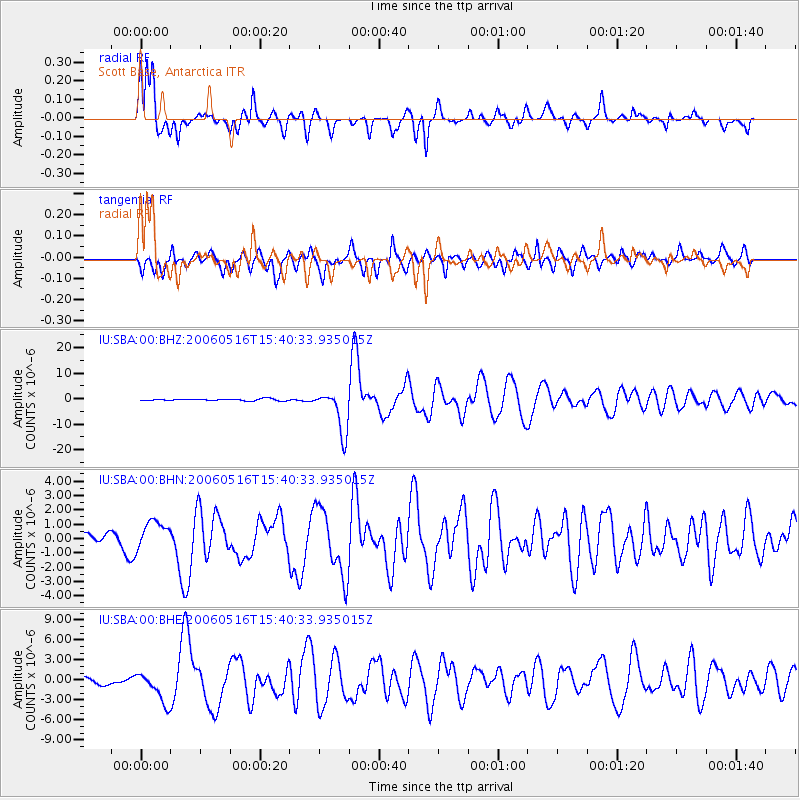
Signal To Noise
| Channel | StoN | STA | LTA |
| IU:SBA:00:BHN:20060516T15:40:33.935015Z | 2.7383769 | 9.911802E-7 | 3.61959E-7 |
| IU:SBA:00:BHE:20060516T15:40:33.935015Z | 4.8727727 | 2.3253658E-6 | 4.772162E-7 |
| IU:SBA:00:BHZ:20060516T15:40:33.935015Z | 23.859241 | 8.434005E-6 | 3.534901E-7 |
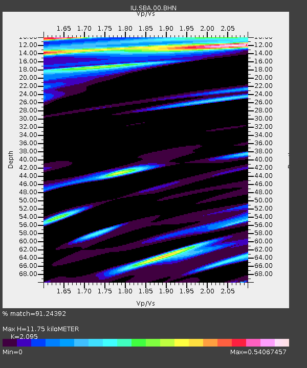
| Arrivals | |
| Ps | 2.1 SECOND |
| PpPs | 5.8 SECOND |
| PsPs/PpSs | 7.9 SECOND |

