You are here: Home > Network List > TA - USArray Transportable Network (new EarthScope stations) Stations List
> Station R11A Troy Canyon, Currant, NV, USA > Earthquake Result Viewer
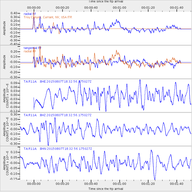
R11A Troy Canyon, Currant, NV, USA - Earthquake Result Viewer
*The percent match for this event was below the threshold and hence no stack was calculated.
| Earthquake location: |
Fiji Islands |
| Earthquake latitude/longitude: |
-16.8/177.3 |
| Earthquake time(UTC): |
2015/08/07 (219) 18:21:00 GMT |
| Earthquake Depth: |
10 km |
| Earthquake Magnitude: |
5.4 MW |
| Earthquake Catalog/Contributor: |
ISC/ISC |
|
| Network: |
TA USArray Transportable Network (new EarthScope stations) |
| Station: |
R11A Troy Canyon, Currant, NV, USA |
| Lat/Lon: |
38.35 N/115.59 W |
| Elevation: |
1756 m |
|
| Distance: |
83.4 deg |
| Az: |
46.816 deg |
| Baz: |
242.654 deg |
| Ray Param: |
$rayparam |
*The percent match for this event was below the threshold and hence was not used in the summary stack. |
|
| Radial Match: |
67.21858 % |
| Radial Bump: |
400 |
| Transverse Match: |
62.806202 % |
| Transverse Bump: |
400 |
| SOD ConfigId: |
7422571 |
| Insert Time: |
2019-04-20 05:26:23.203 +0000 |
| GWidth: |
2.5 |
| Max Bumps: |
400 |
| Tol: |
0.001 |
|
Signal To Noise
| Channel | StoN | STA | LTA |
| TA:R11A: :BHZ:20150807T18:32:56.175027Z | 1.7244216 | 8.75141E-8 | 5.074983E-8 |
| TA:R11A: :BHN:20150807T18:32:56.175027Z | 0.63873327 | 2.1626269E-8 | 3.3858058E-8 |
| TA:R11A: :BHE:20150807T18:32:56.175027Z | 1.550442 | 6.7381336E-8 | 4.3459433E-8 |
| Arrivals |
| Ps | |
| PpPs | |
| PsPs/PpSs | |


