You are here: Home > Network List > AG - Arkansas Seismic Network Stations List
> Station LCAR Lake Charles,AR > Earthquake Result Viewer
LCAR Lake Charles,AR - Earthquake Result Viewer

| Earthquake location: |
Tonga Islands |
| Earthquake latitude/longitude: |
-15.2/-173.2 |
| Earthquake time(UTC): |
2015/04/07 (097) 00:46:18 GMT |
| Earthquake Depth: |
10 km |
| Earthquake Magnitude: |
5.8 MB |
| Earthquake Catalog/Contributor: |
NEIC PDE/NEIC ALERT |
|
| Network: |
AG Arkansas Seismic Network |
| Station: |
LCAR Lake Charles,AR |
| Lat/Lon: |
36.07 N/91.15 W |
| Elevation: |
103 m |
|
| Distance: |
92.6 deg |
| Az: |
53.44 deg |
| Baz: |
253.175 deg |
| Ray Param: |
0.041433103 |
| Estimated Moho Depth: |
19.75 km |
| Estimated Crust Vp/Vs: |
1.92 |
| Assumed Crust Vp: |
6.53 km/s |
| Estimated Crust Vs: |
3.397 km/s |
| Estimated Crust Poisson's Ratio: |
0.31 |
|
| Radial Match: |
86.95309 % |
| Radial Bump: |
347 |
| Transverse Match: |
72.12599 % |
| Transverse Bump: |
400 |
| SOD ConfigId: |
872571 |
| Insert Time: |
2015-04-21 00:59:26.639 +0000 |
| GWidth: |
2.5 |
| Max Bumps: |
400 |
| Tol: |
0.001 |
|
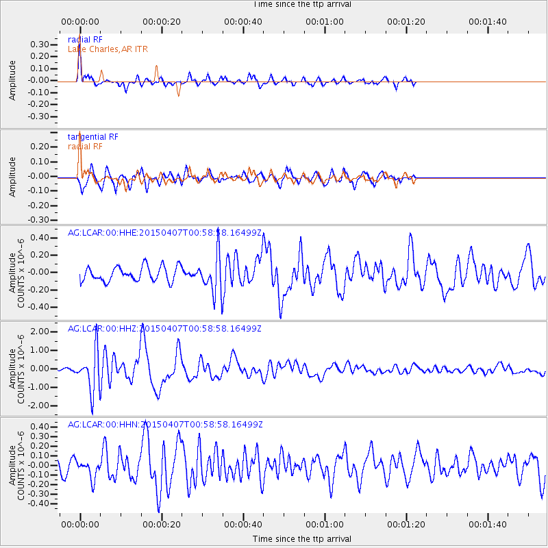
Signal To Noise
| Channel | StoN | STA | LTA |
| AG:LCAR:00:HHZ:20150407T00:58:58.16499Z | 18.505402 | 1.1052297E-6 | 5.972471E-8 |
| AG:LCAR:00:HHN:20150407T00:58:58.16499Z | 1.8068199 | 9.932972E-8 | 5.4974887E-8 |
| AG:LCAR:00:HHE:20150407T00:58:58.16499Z | 2.6295364 | 2.2221901E-7 | 8.450882E-8 |
| Arrivals |
| Ps | 2.8 SECOND |
| PpPs | 8.7 SECOND |
| PsPs/PpSs | 12 SECOND |


