
INCN Inchon, Republic of Korea - Earthquake Result Viewer
| ||||||||||||||||||
| ||||||||||||||||||
| ||||||||||||||||||
|
Signal To Noise
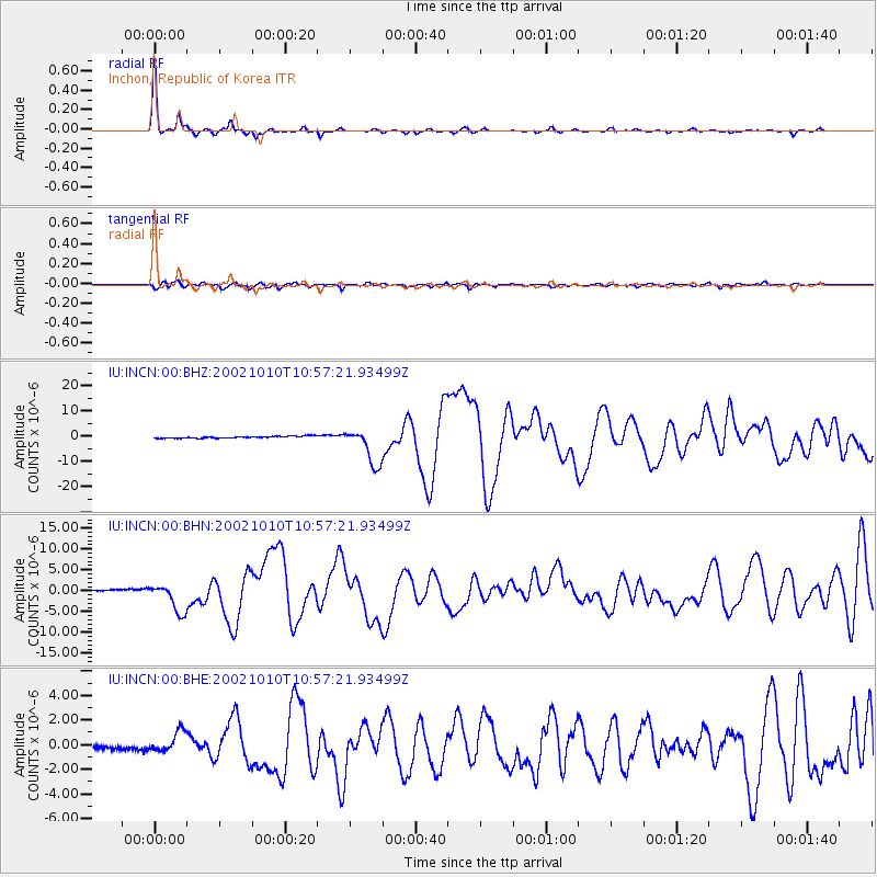
| Channel | StoN | STA | LTA |
| IU:INCN:00:BHN:20021010T10:57:21.93499Z | 14.264372 | 3.456965E-6 | 2.423496E-7 |
| IU:INCN:00:BHE:20021010T10:57:21.93499Z | 5.475194 | 8.567452E-7 | 1.5647761E-7 |
| IU:INCN:00:BHZ:20021010T10:57:21.93499Z | 19.240484 | 7.250776E-6 | 3.7684998E-7 |
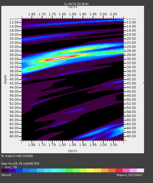
| Arrivals | |
| Ps | 3.8 SECOND |
| PpPs | 12 SECOND |
| PsPs/PpSs | 16 SECOND |

